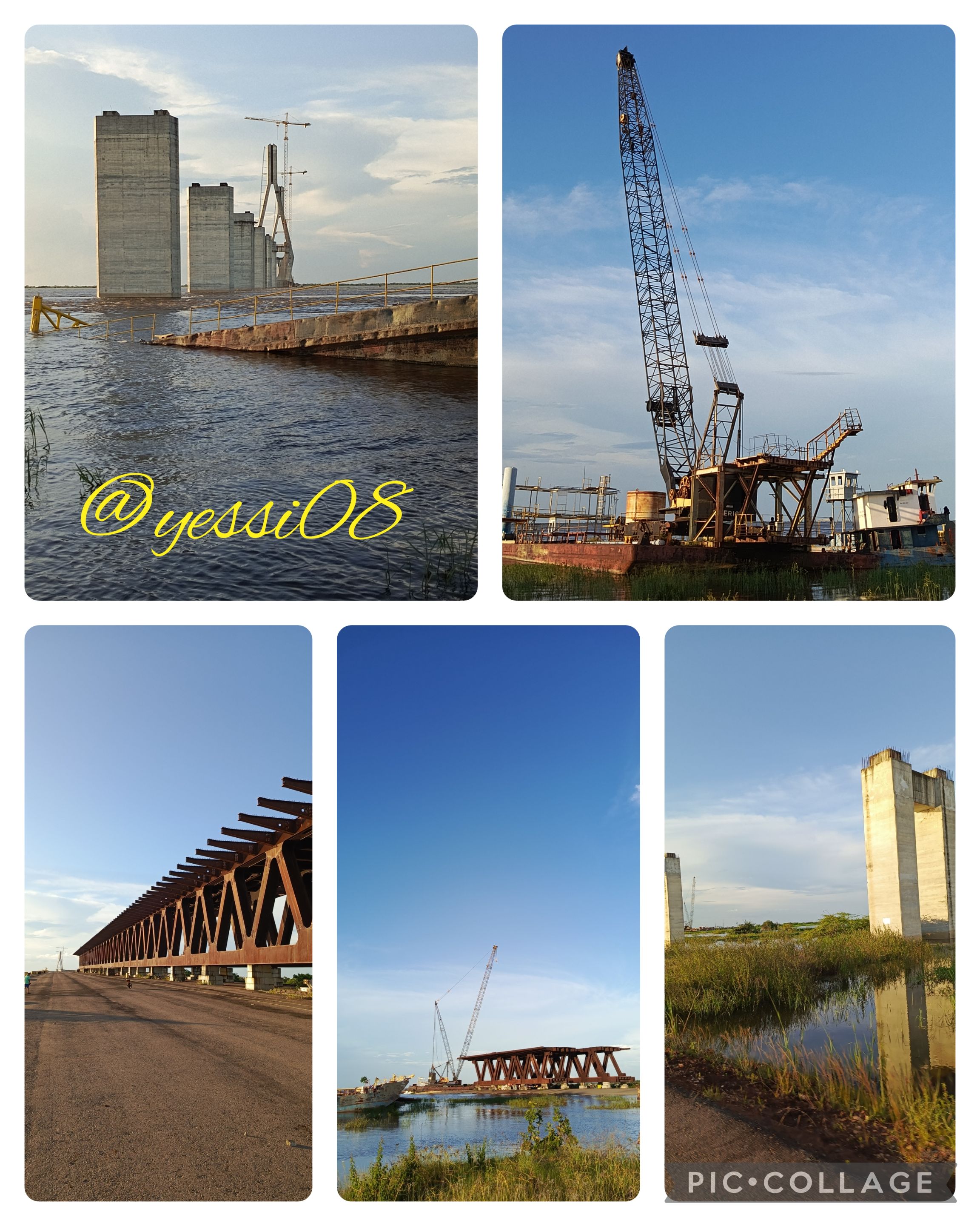
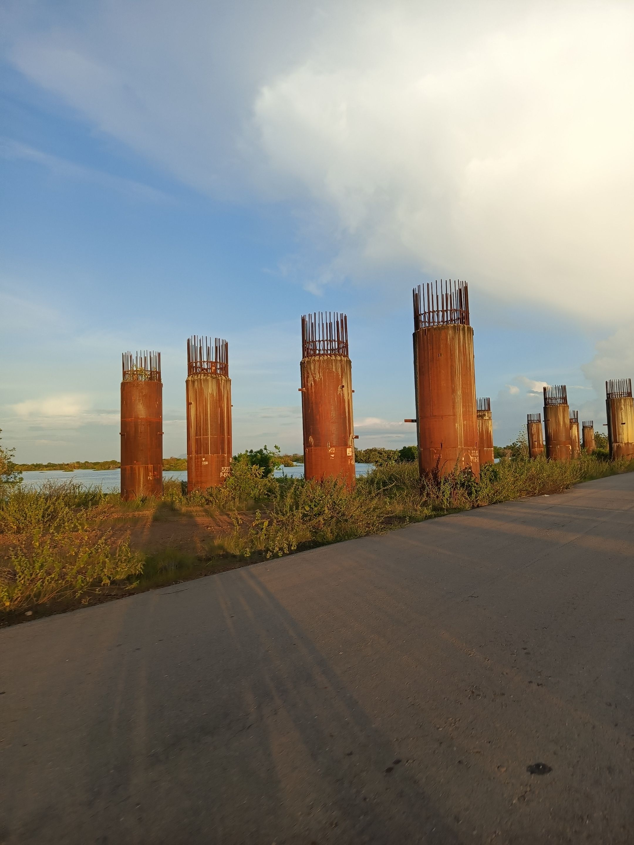
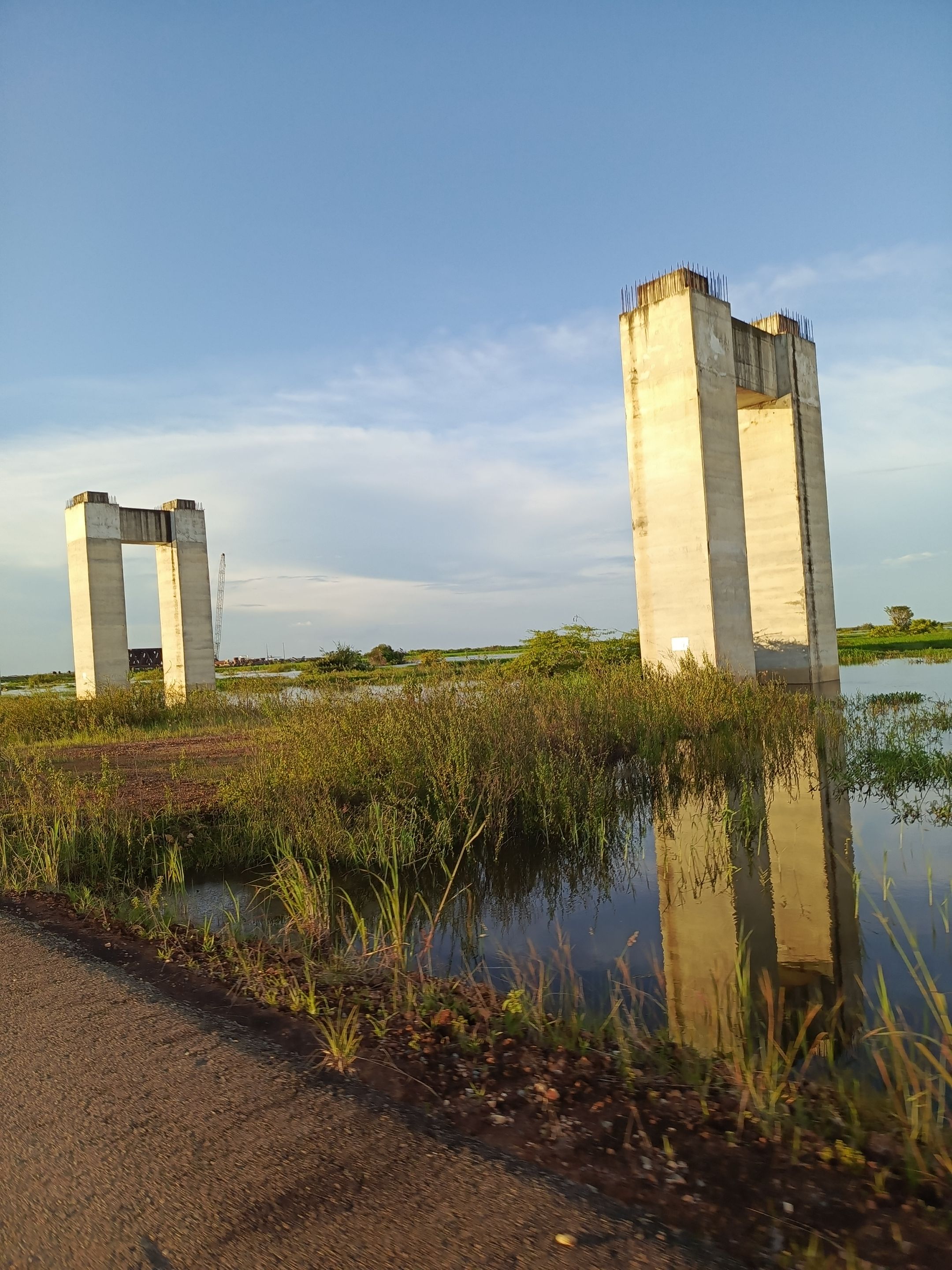
Saludos amigos viajeros, espero se encuentren bien; quiero compartir con ustedes una salida que hicimos en familia el día de ayer hacia una región de acá del Estado Bolívar llamada Punta Brava por donde pasa el río Orinoco ; específicamente fuimos a visitar lo que son los pilotes donde se construiría el tercer puente sobre el río Orinoco; el cual sería el segundo puente más grande de latinoamérica y el 38 en todo el mundo.
Esta obra se inició en el año 2006 y se esperaba que para el próximo mes de octubre estaría concluida, se darían unos dos meses de prueba y se estaría inaugurando para diciembre de este año, fecha que corresponde con la celebración del Bicentenario de la fundación del estado Bolívar.
Dicha estructura busca unir los estados Guárico Bolívar y Amazonas, e incrementar el turismo en la región; hace ya varios años que este trabajo fue abandonado, se puede decir que no quedó ni al 50% de avance, a la fecha que debía estar concluido.
Greetings fellow travelers, I hope you are well; I want to share with you an outing we made with family yesterday to a region here in Bolivar State called Punta Brava where the Orinoco River passes; specifically we went to visit what are the piles where the third bridge over the Orinoco River would be built; which would be the second largest bridge in Latin America and the 38th in the world.
This work began in 2006 and it was expected to be completed by next October, with a two-month test period, and it would be inaugurated in December of this year, date that corresponds to the celebration of the Bicentennial of the founding of the state of Bolivar.
This structure seeks to unite the states of Guárico, Bolívar and Amazonas, and to increase tourism in the region; this work was abandoned several years ago, it can be said that it was not even 50% complete at the date it was supposed to be finished.
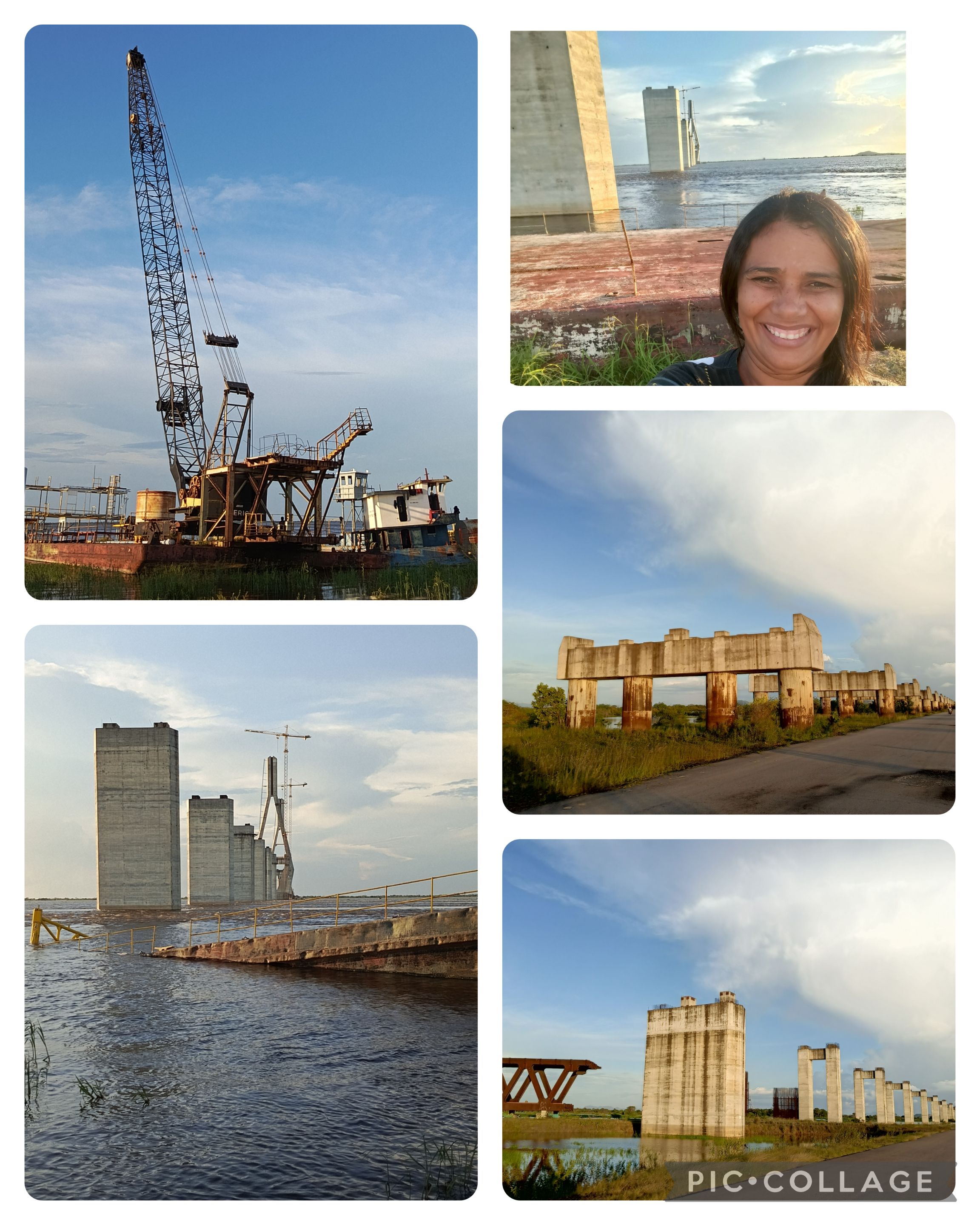
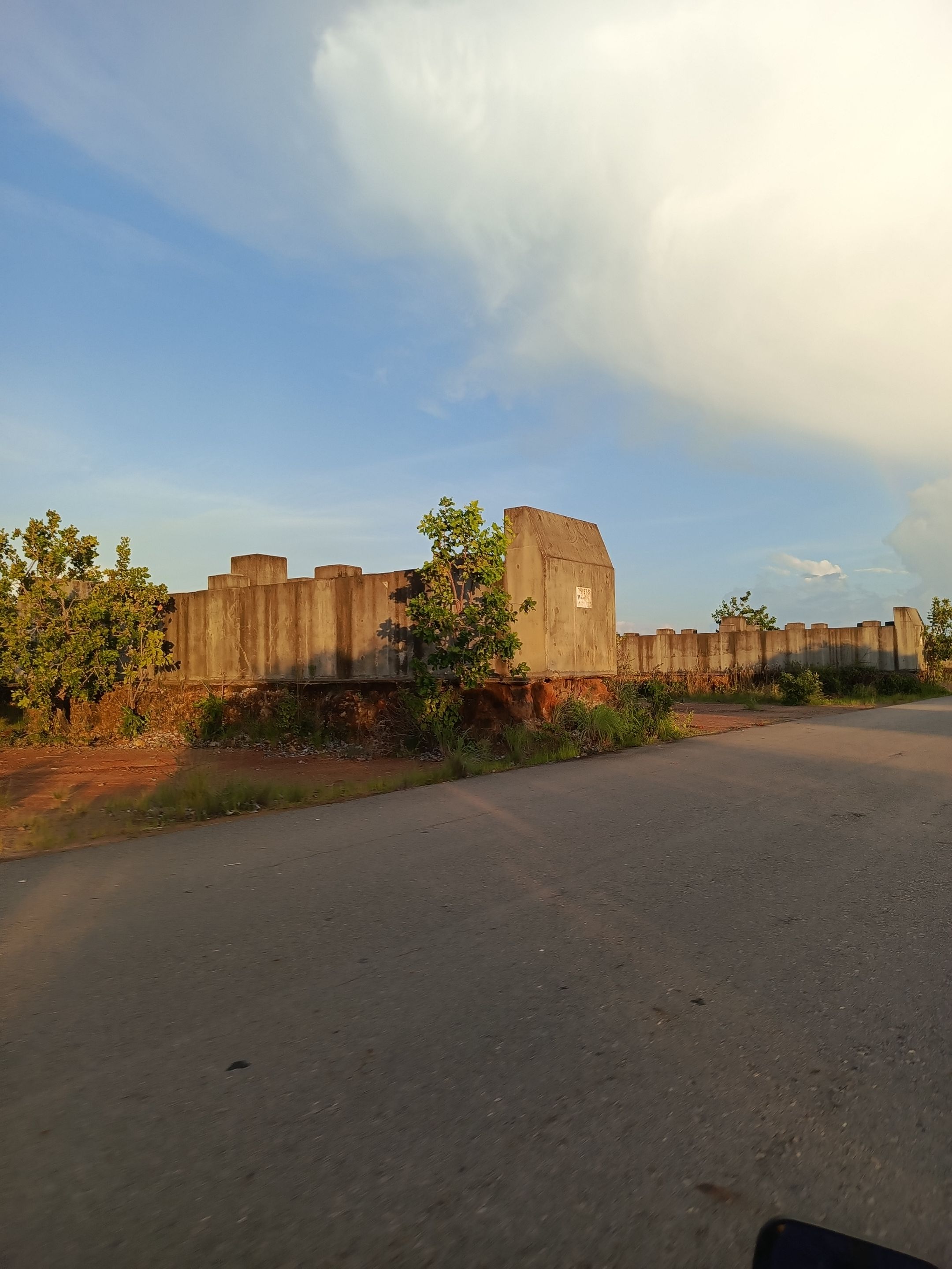
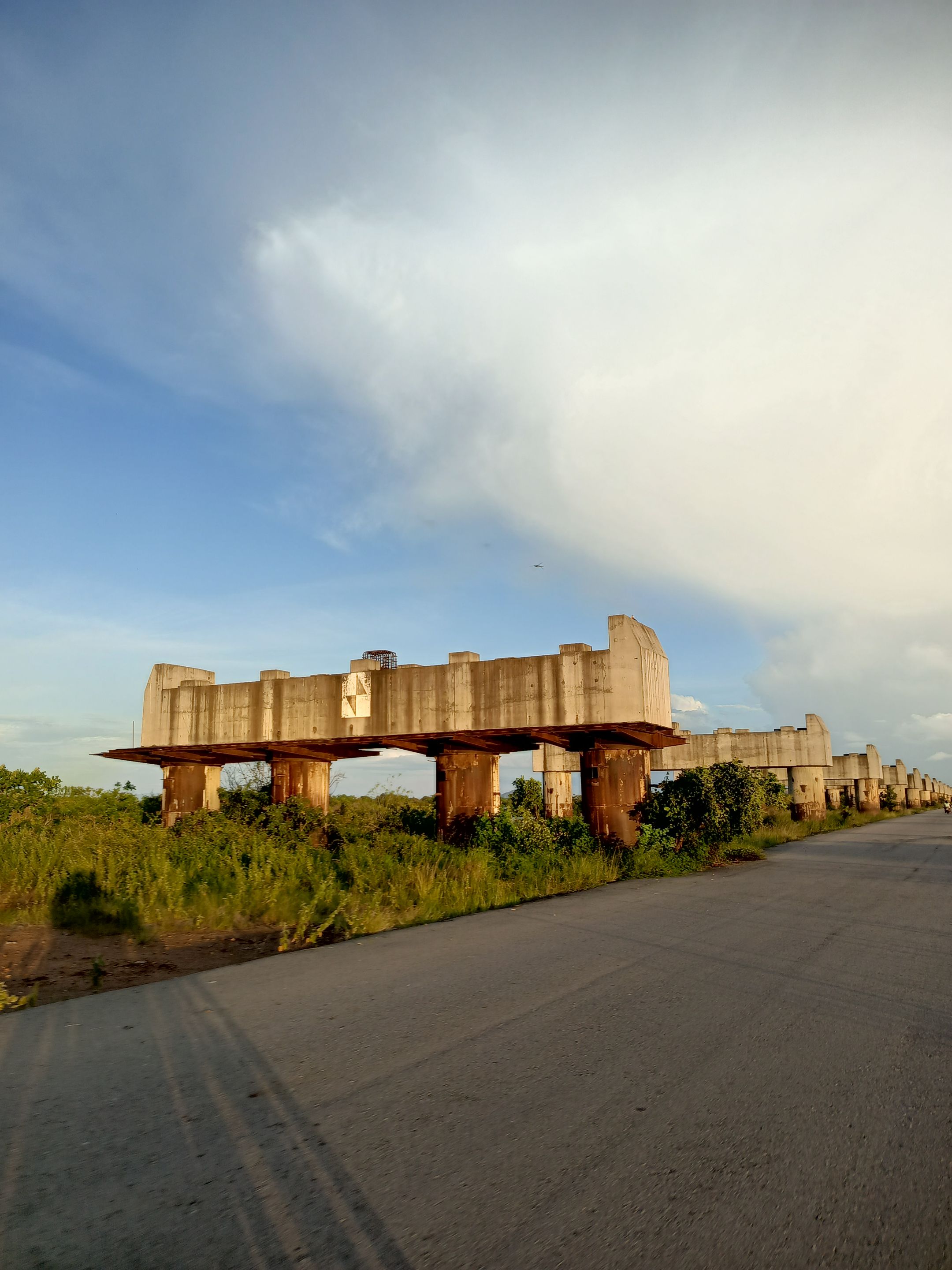
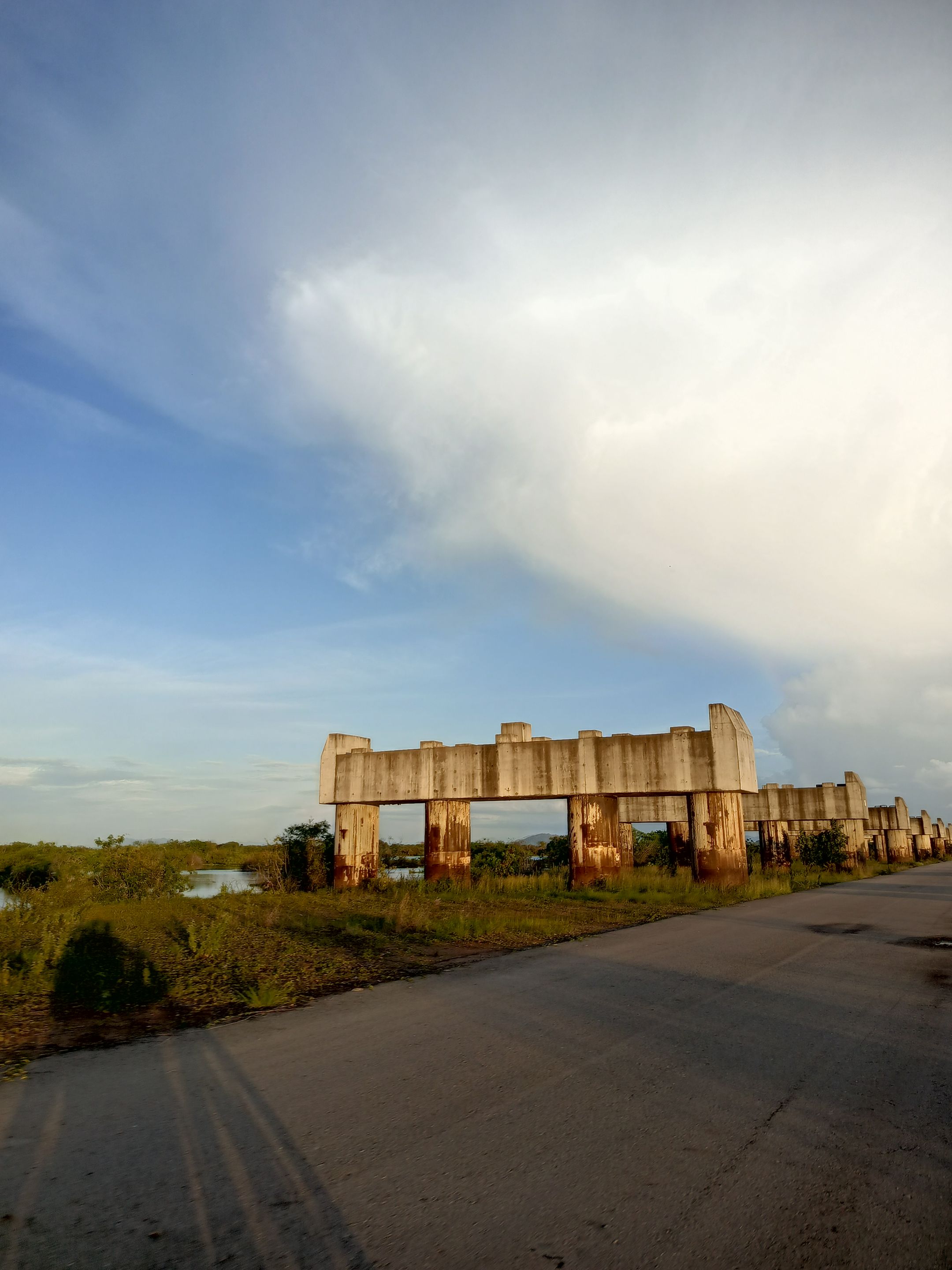
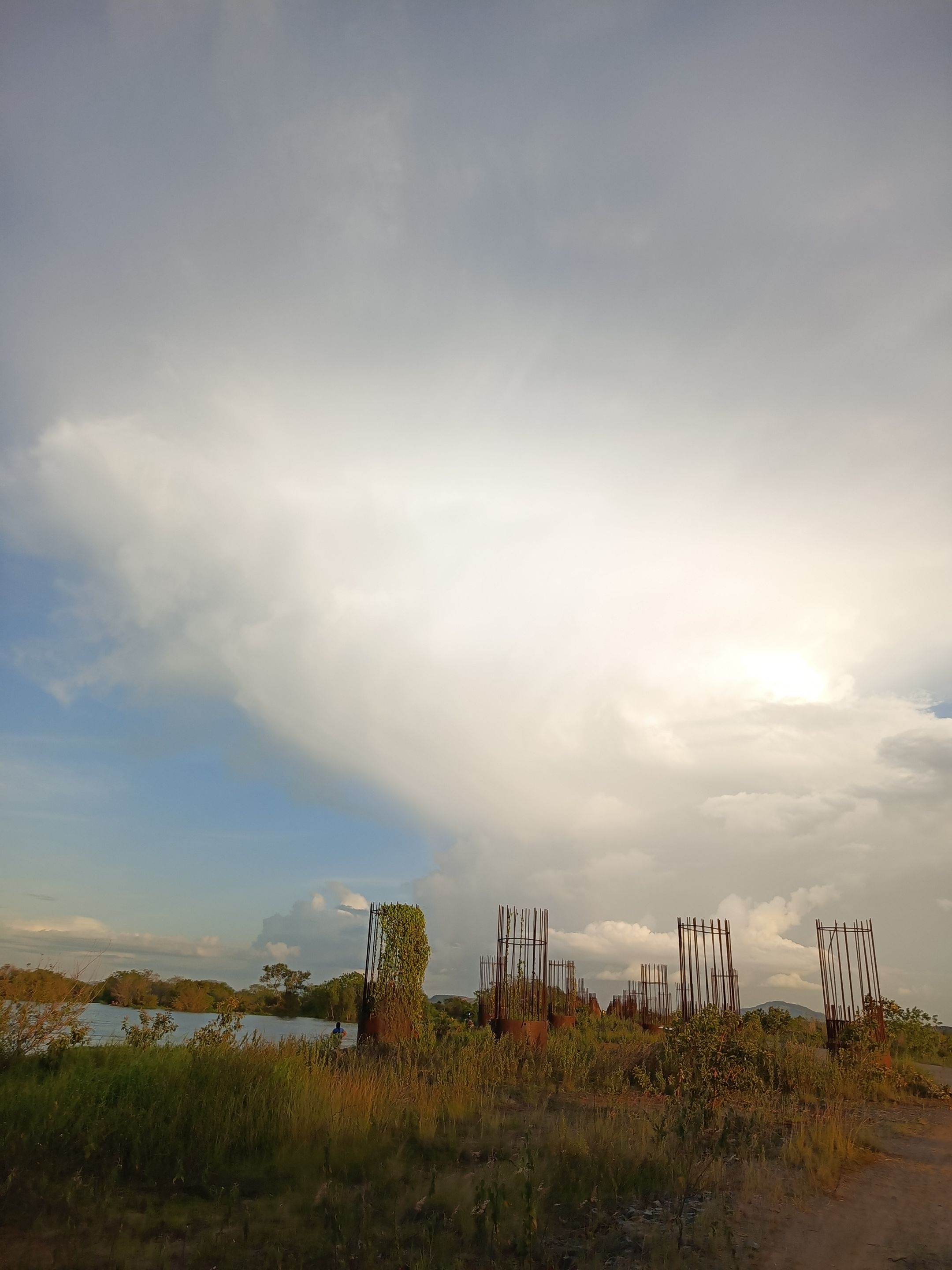
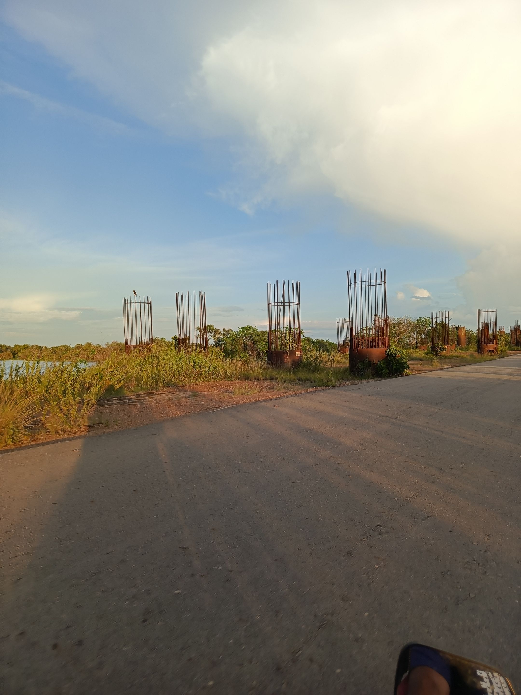
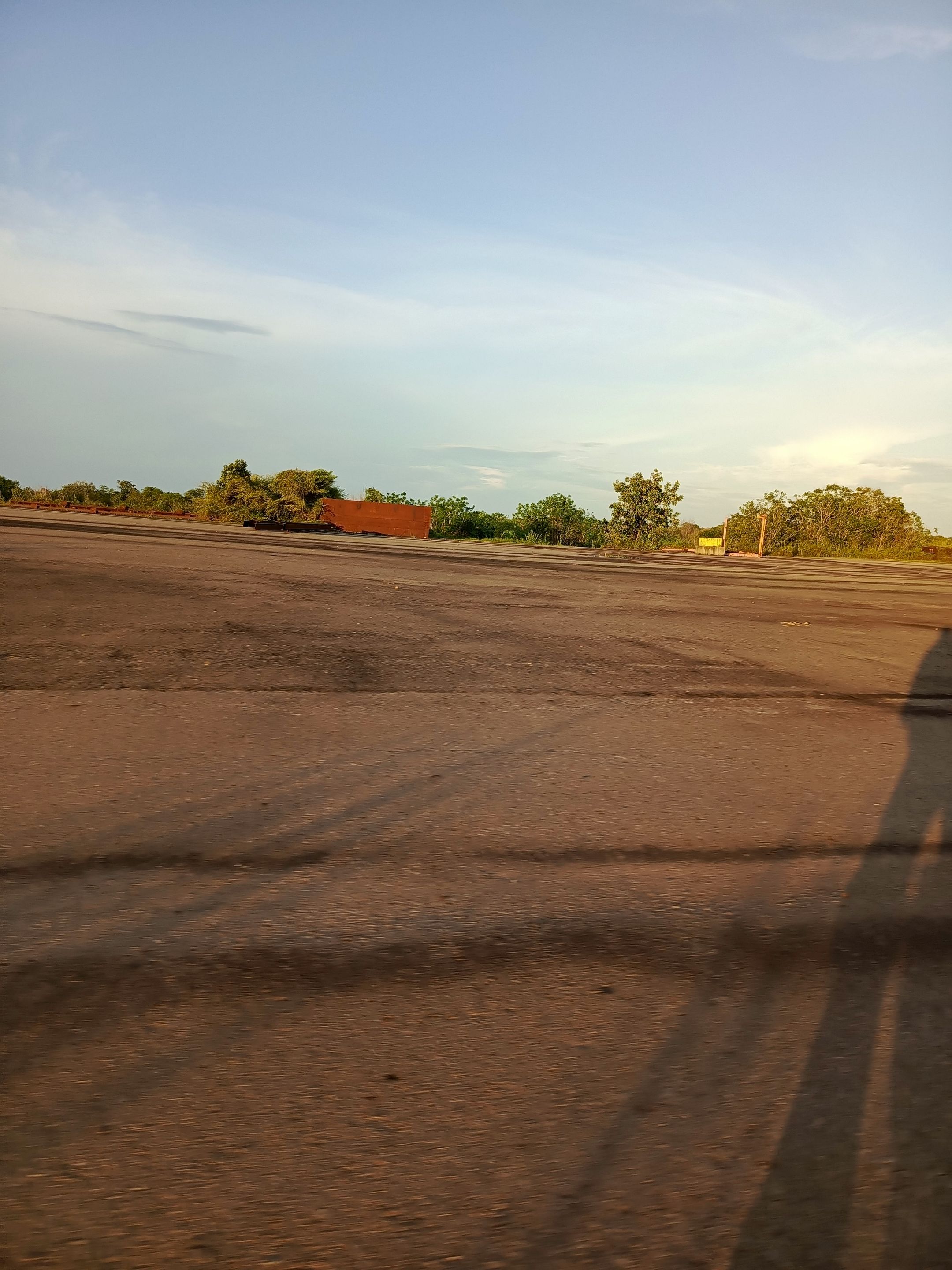
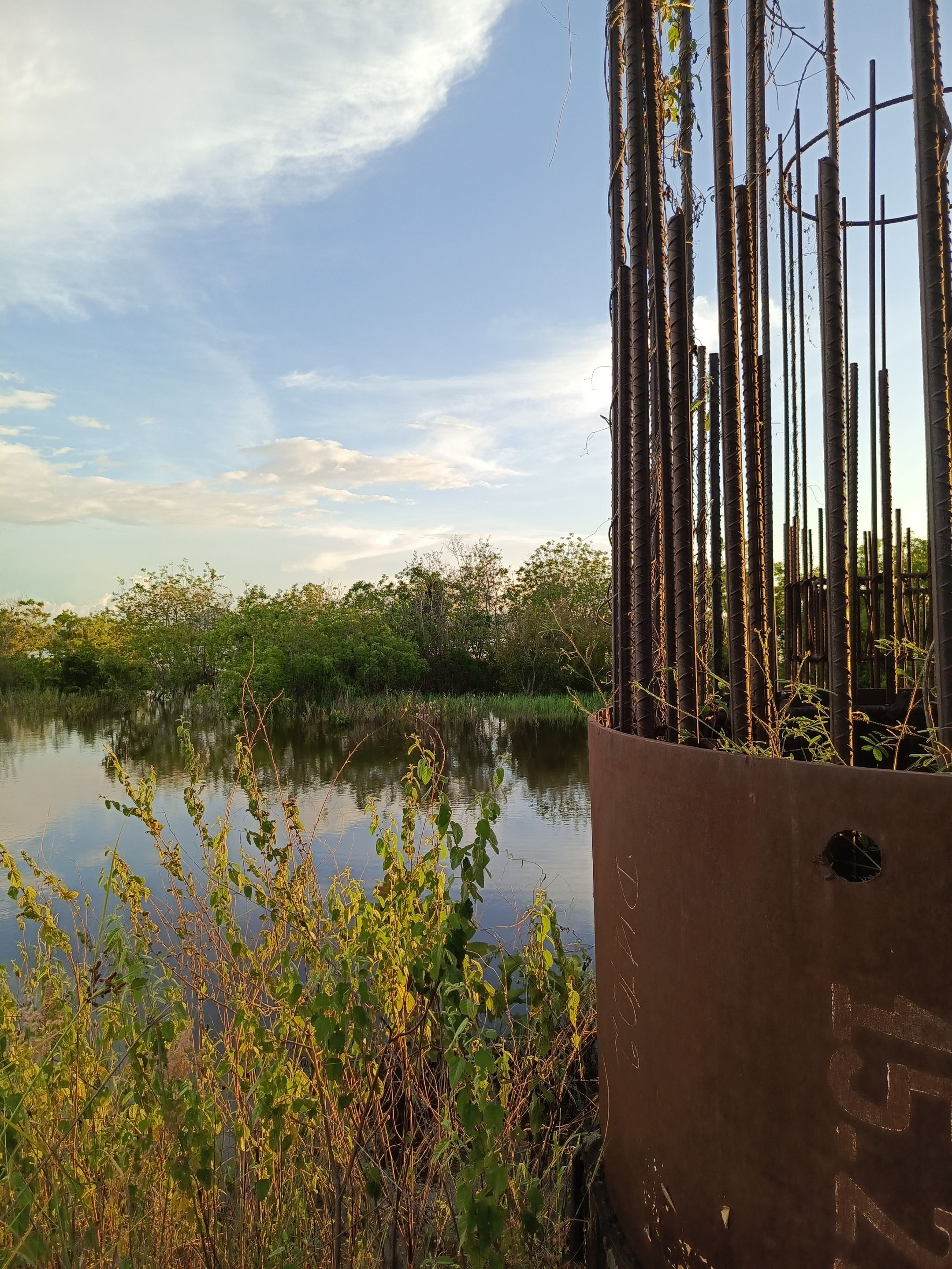
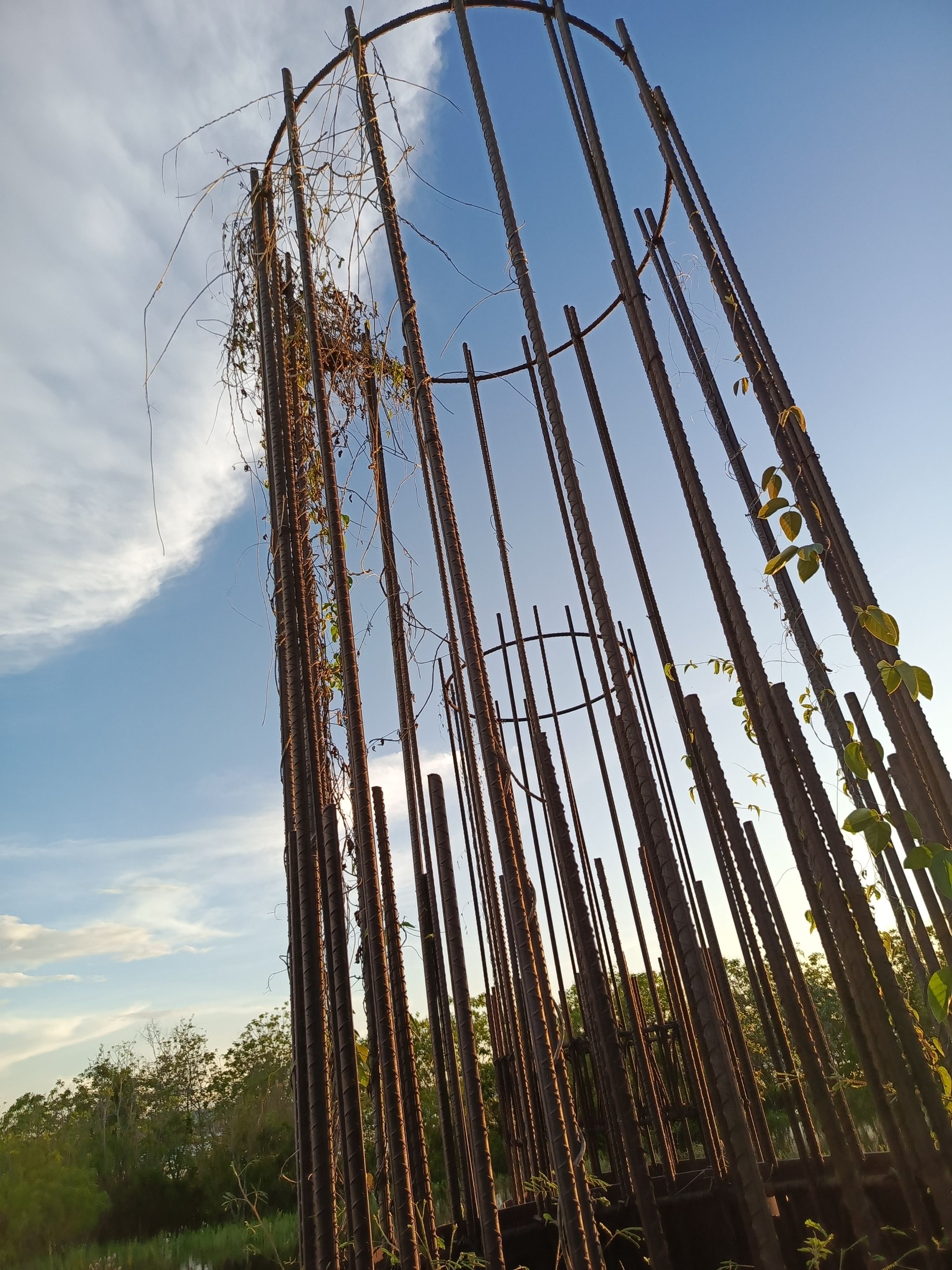
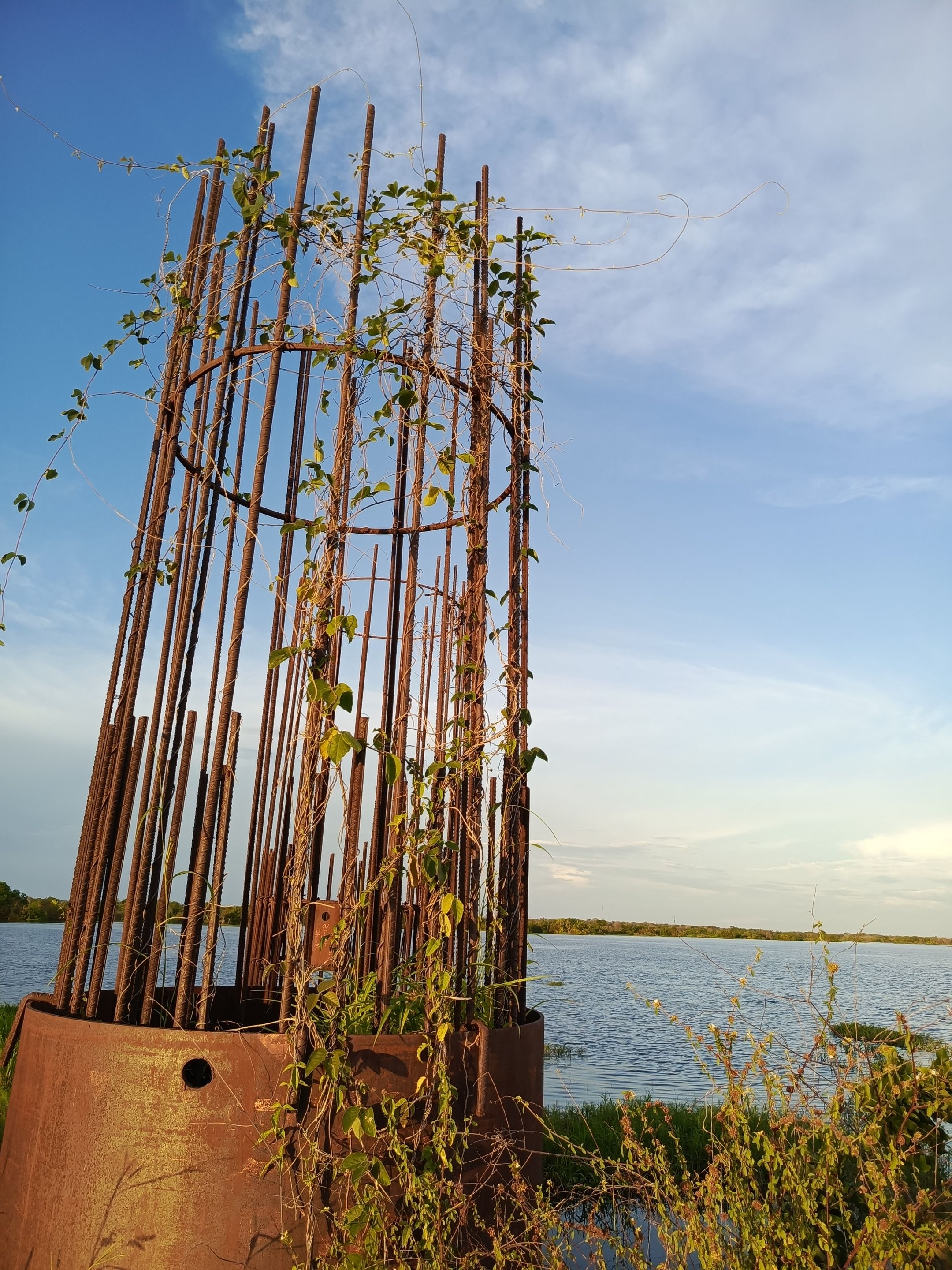
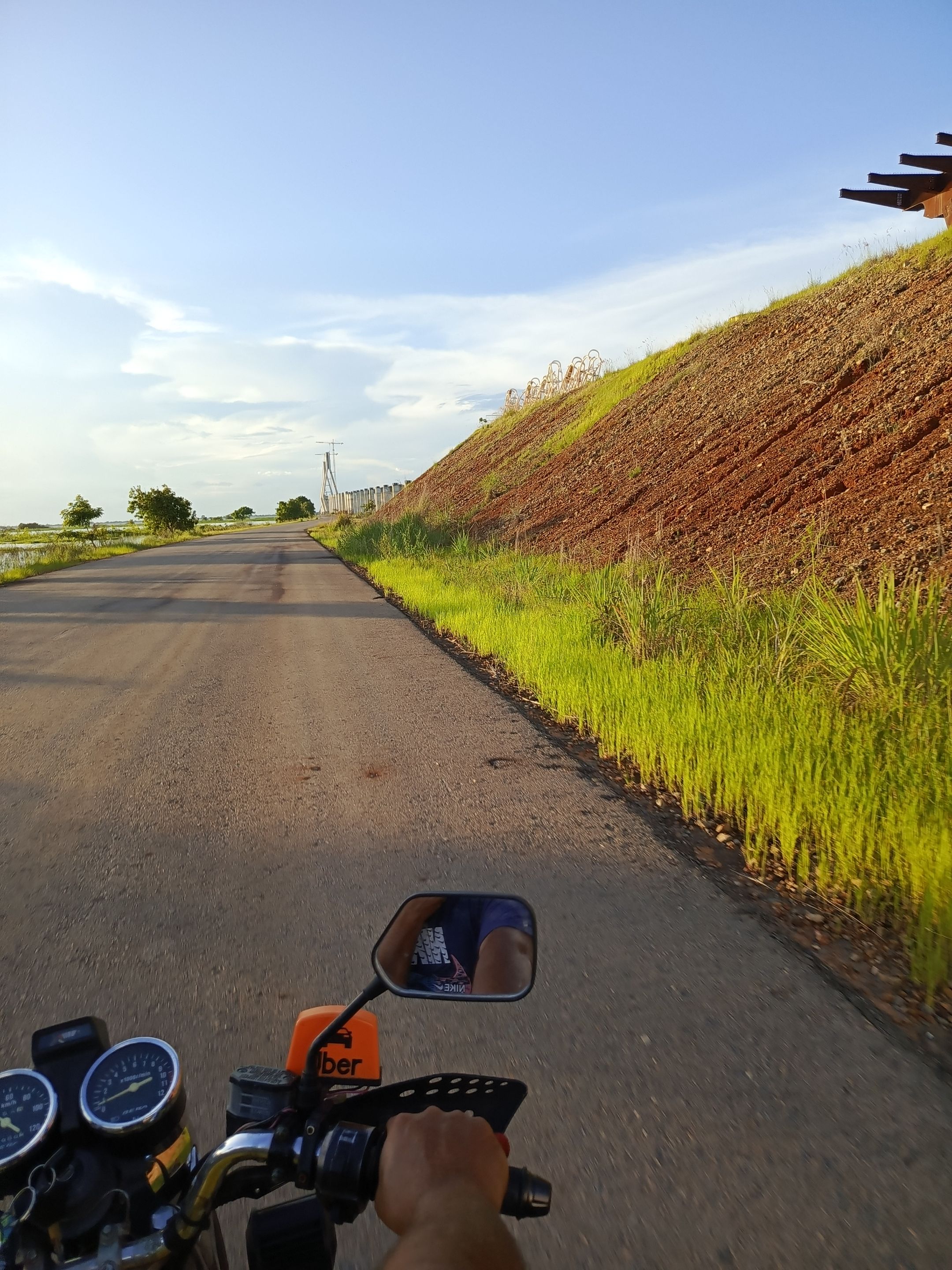
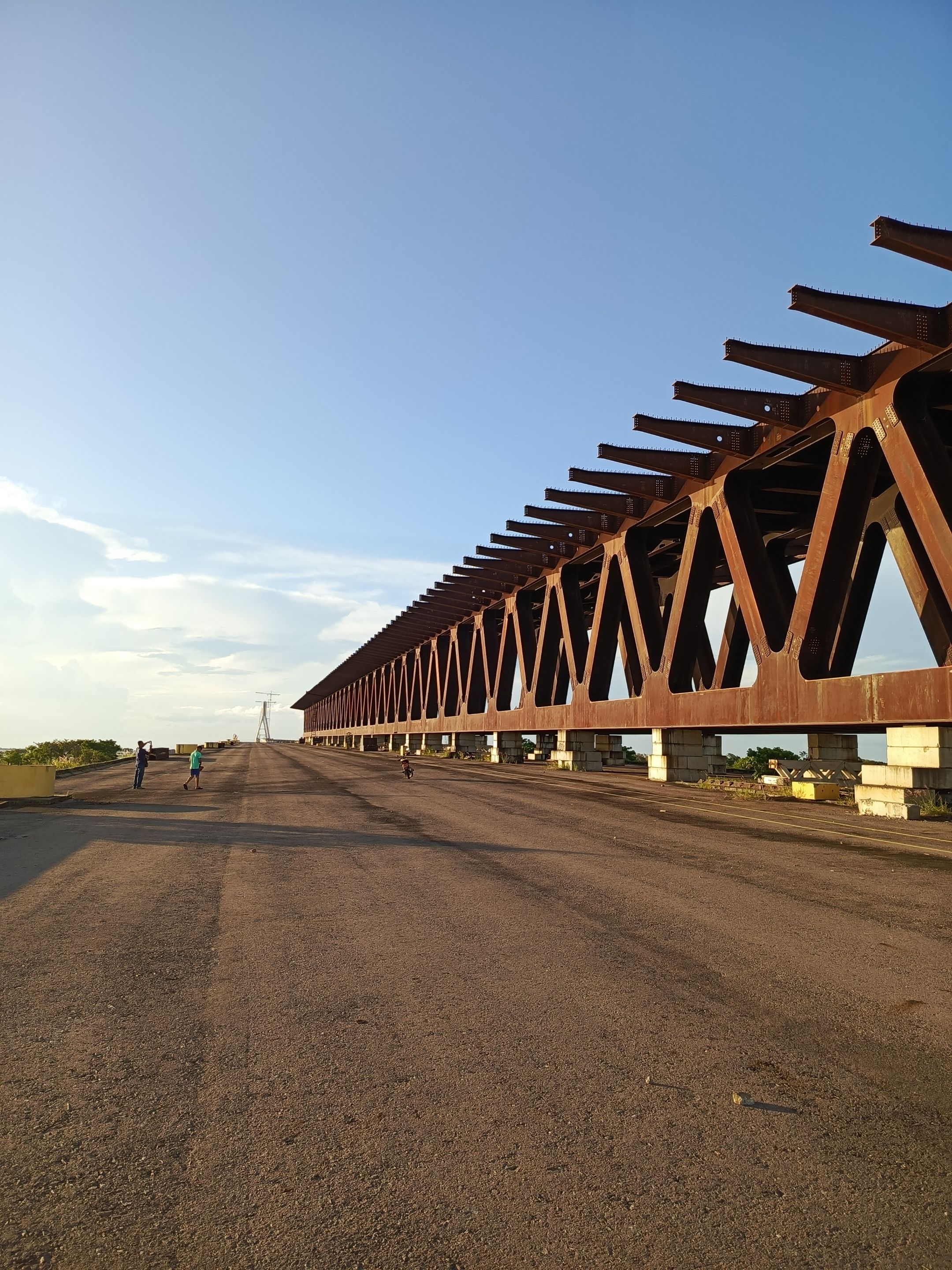
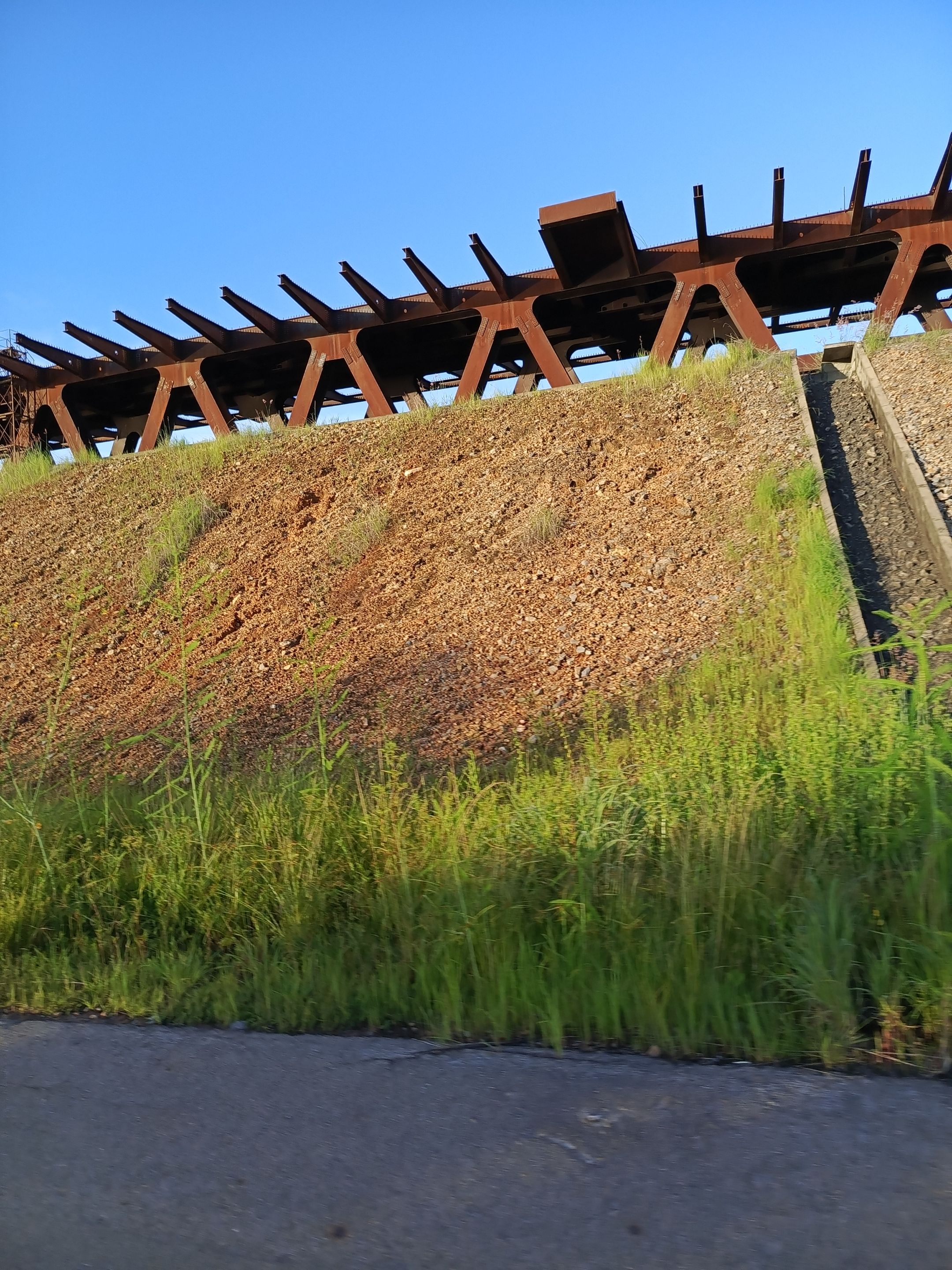
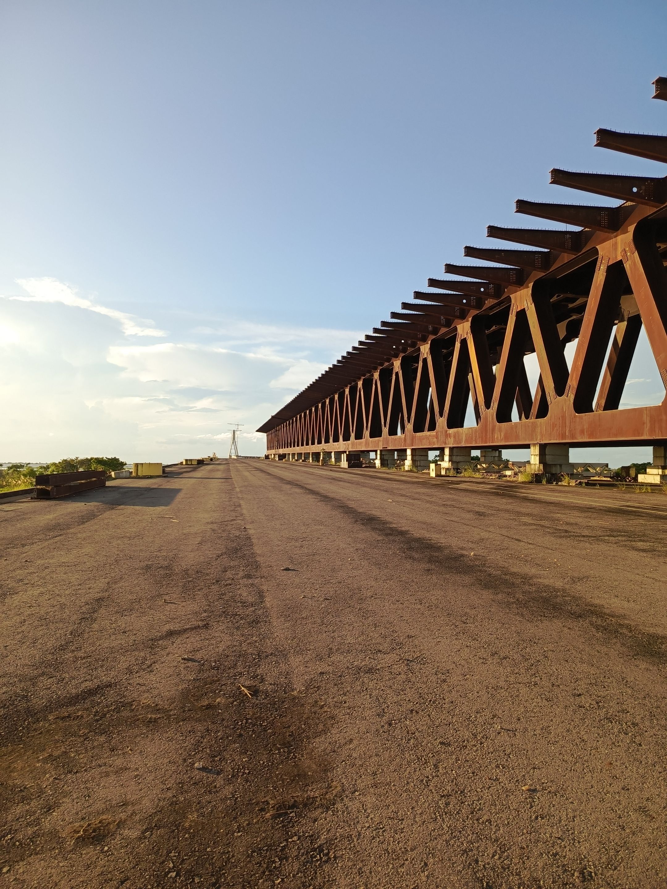
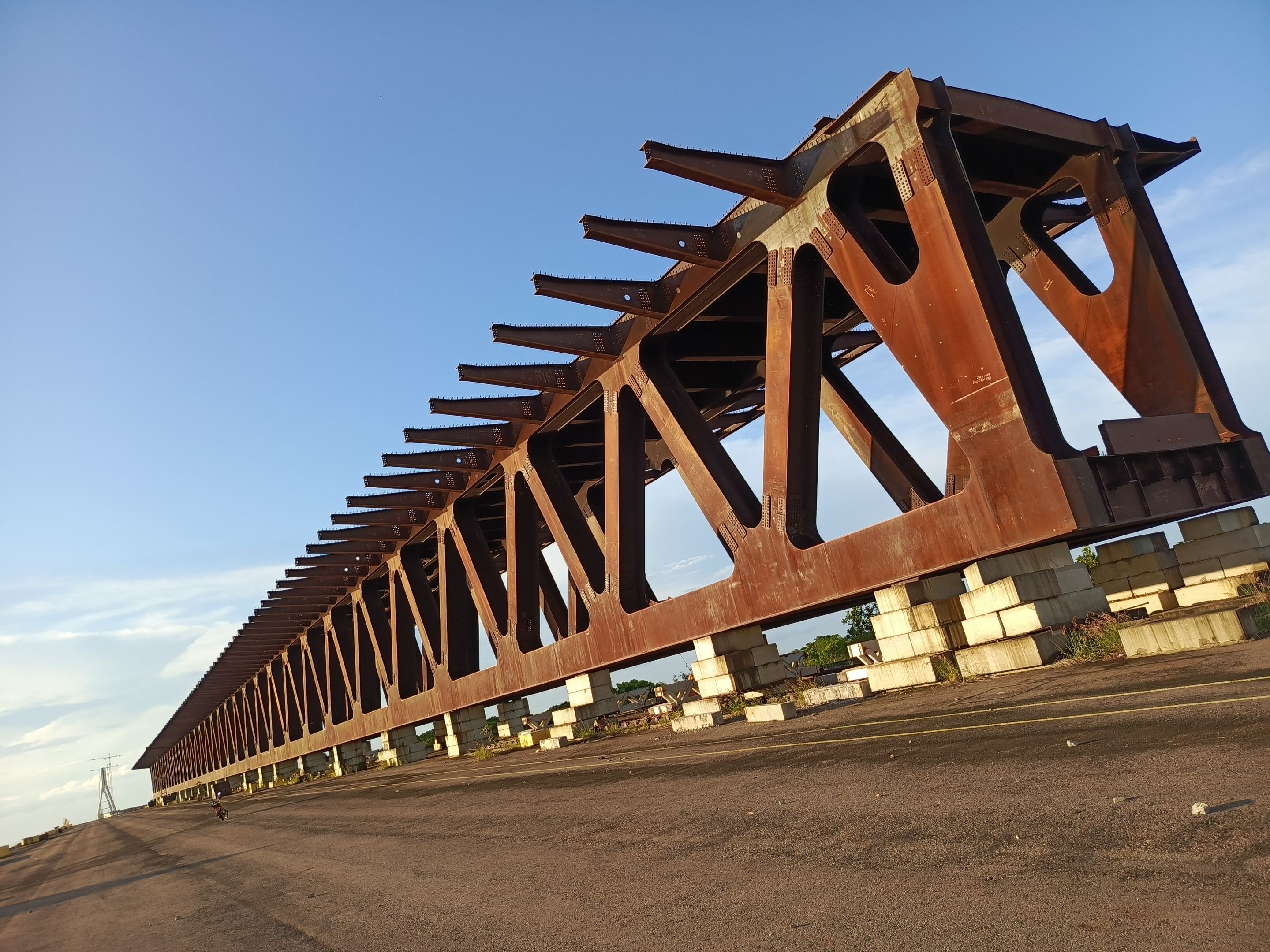
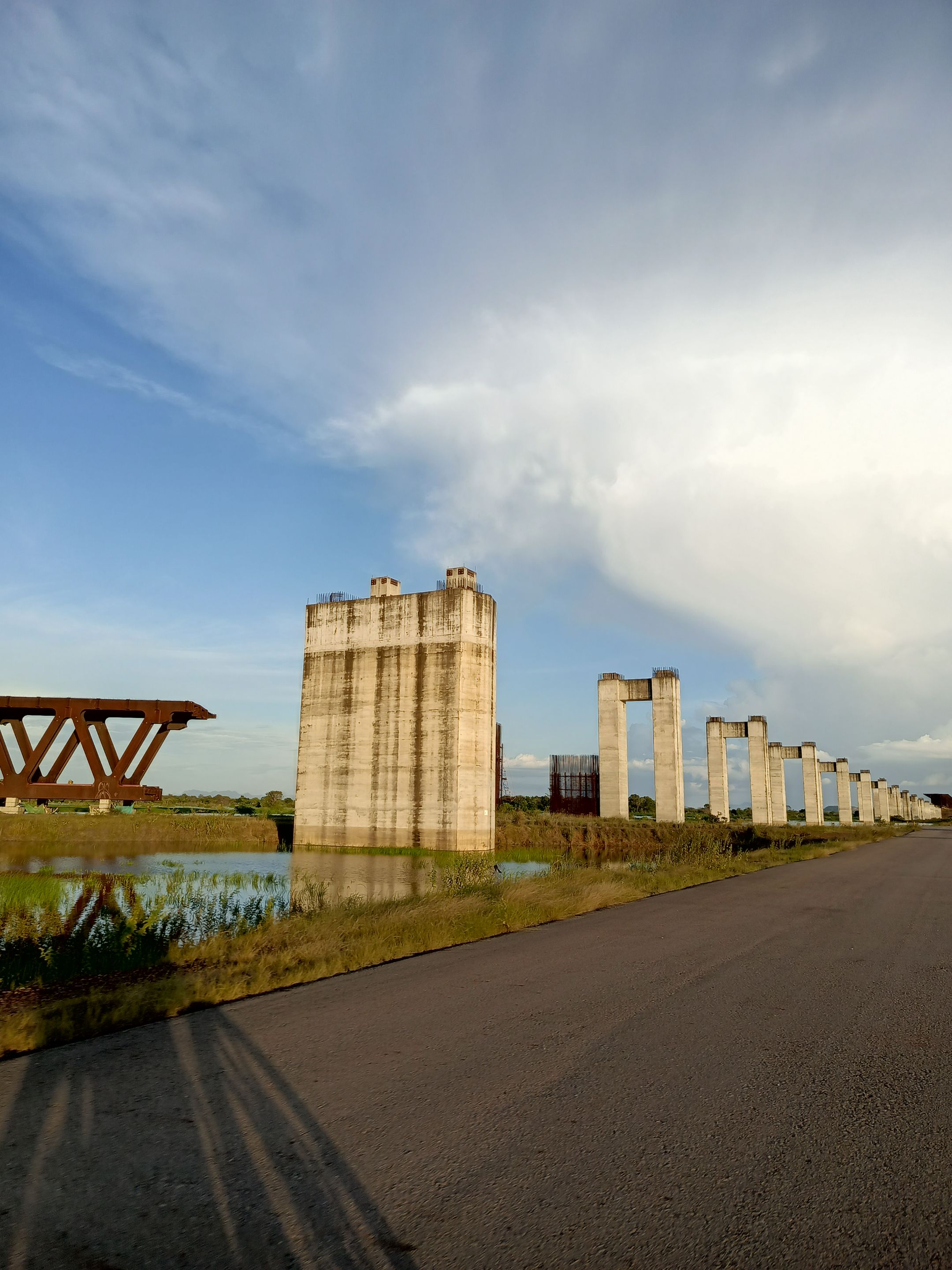
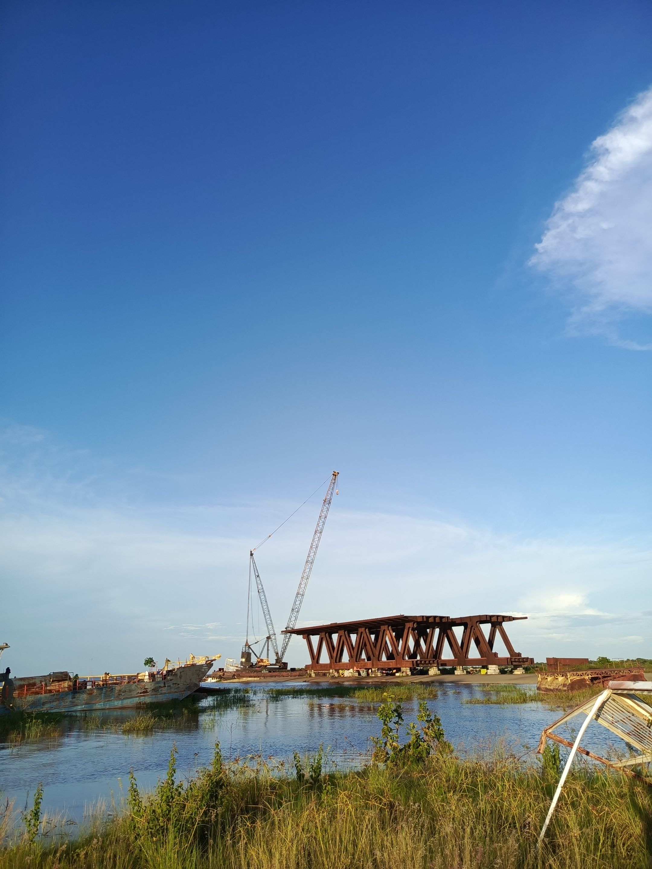
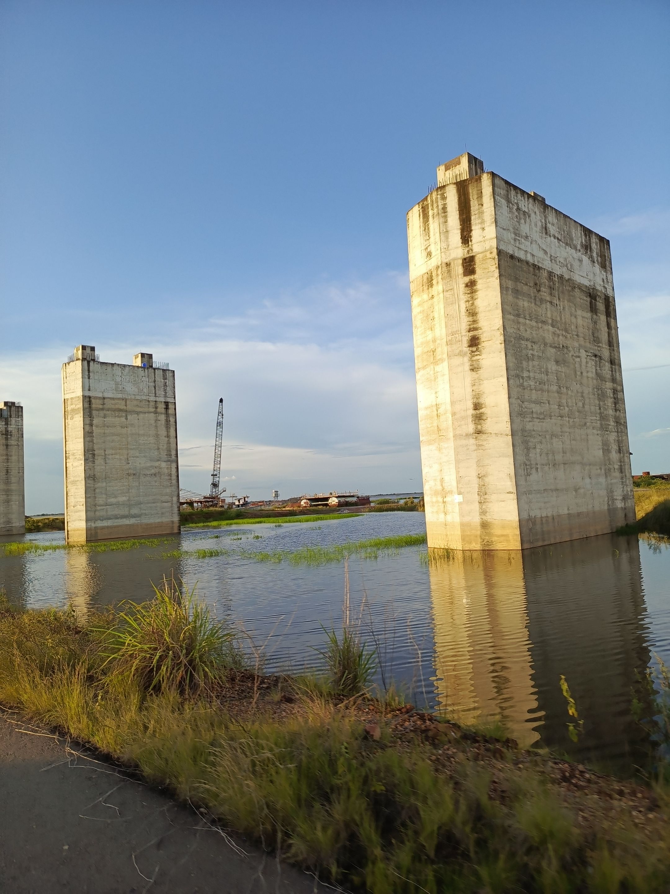
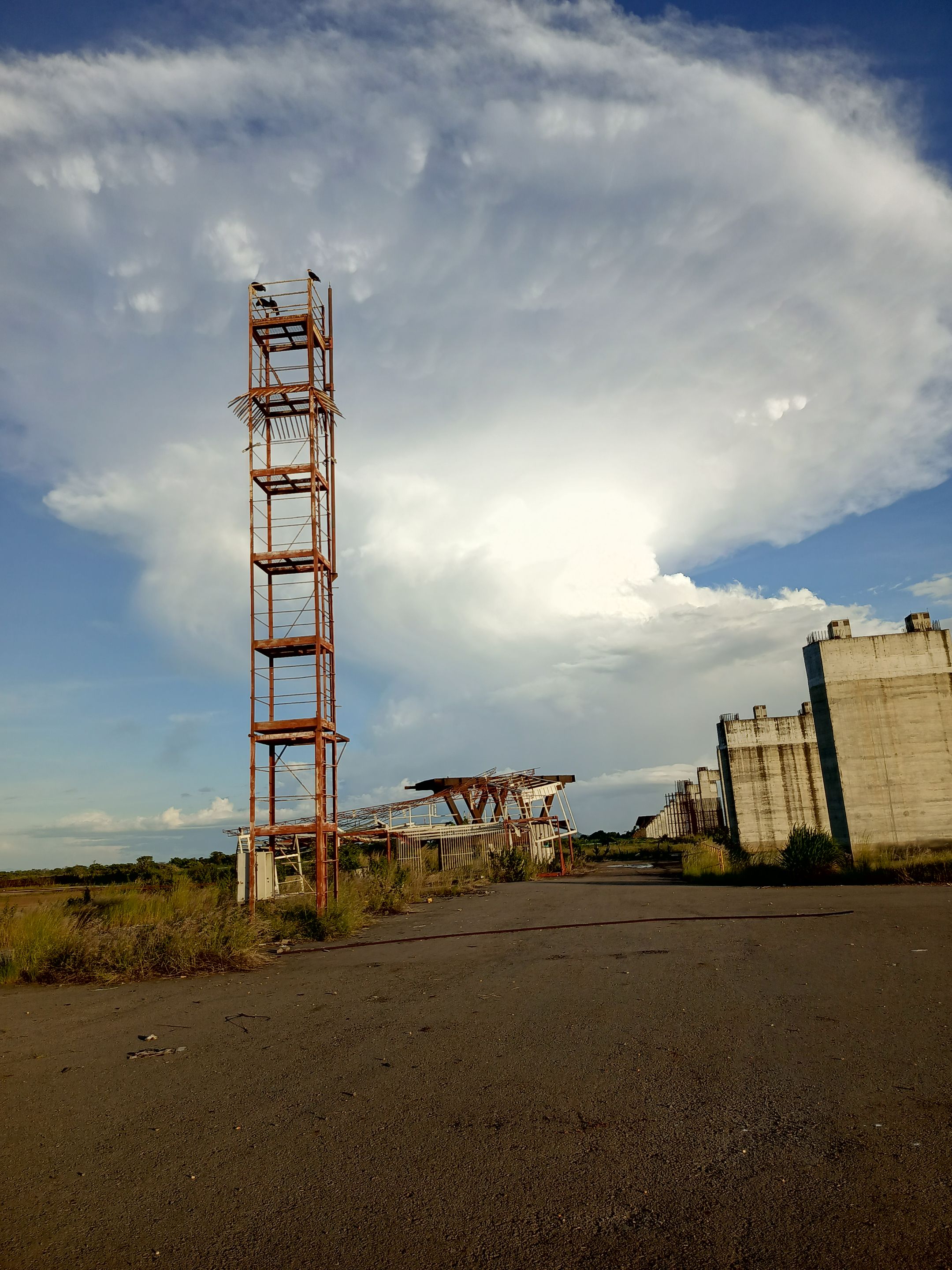
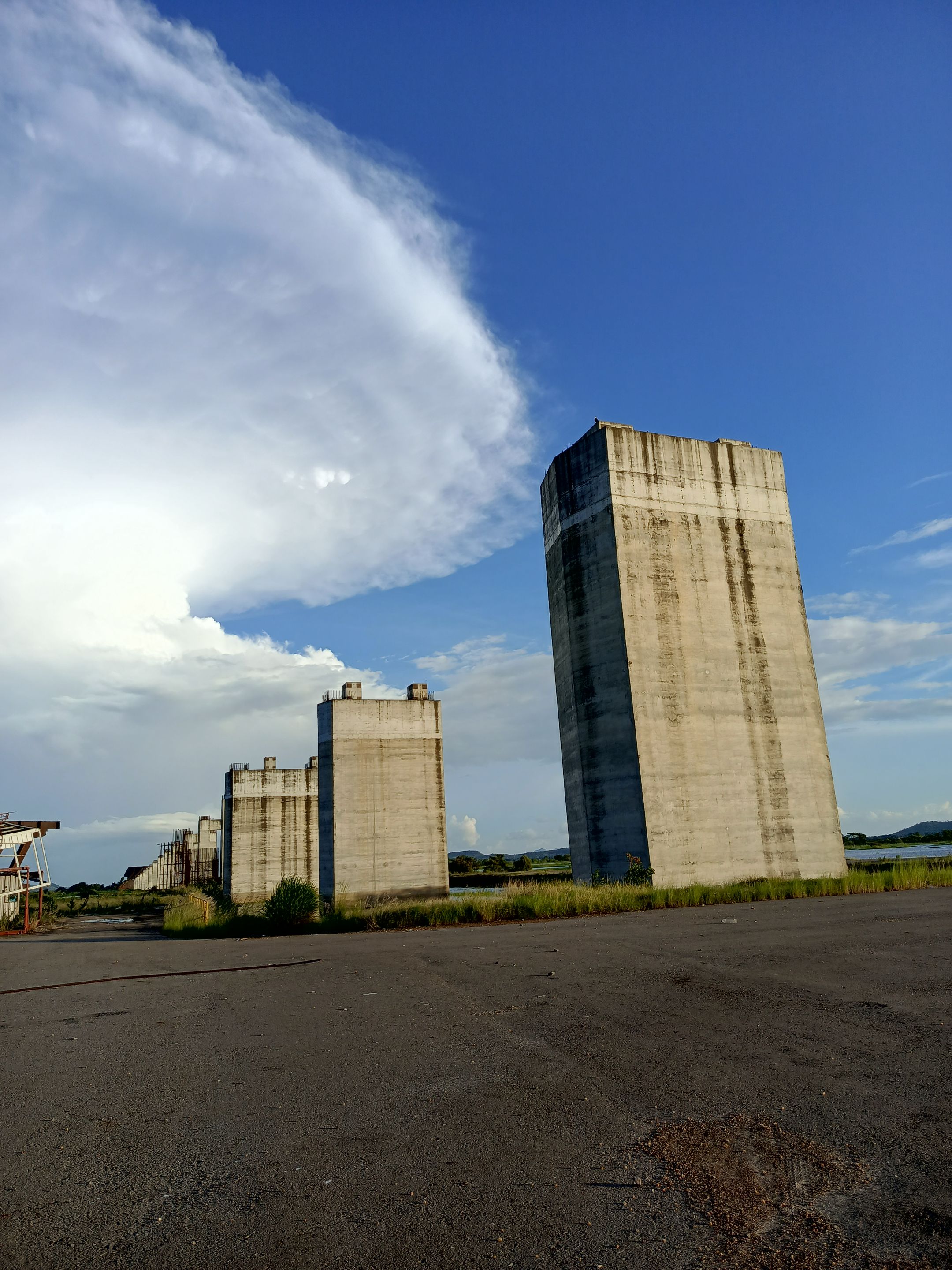
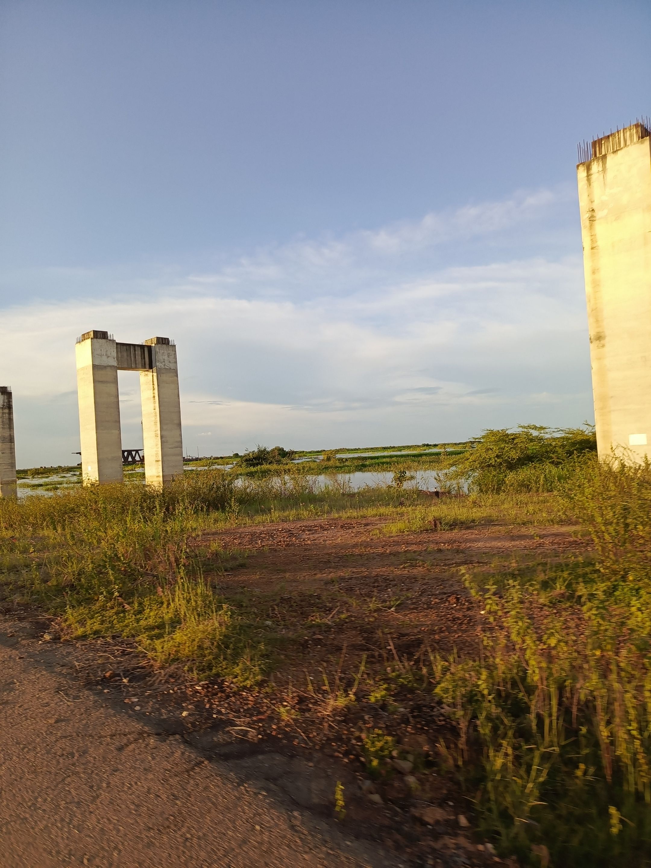
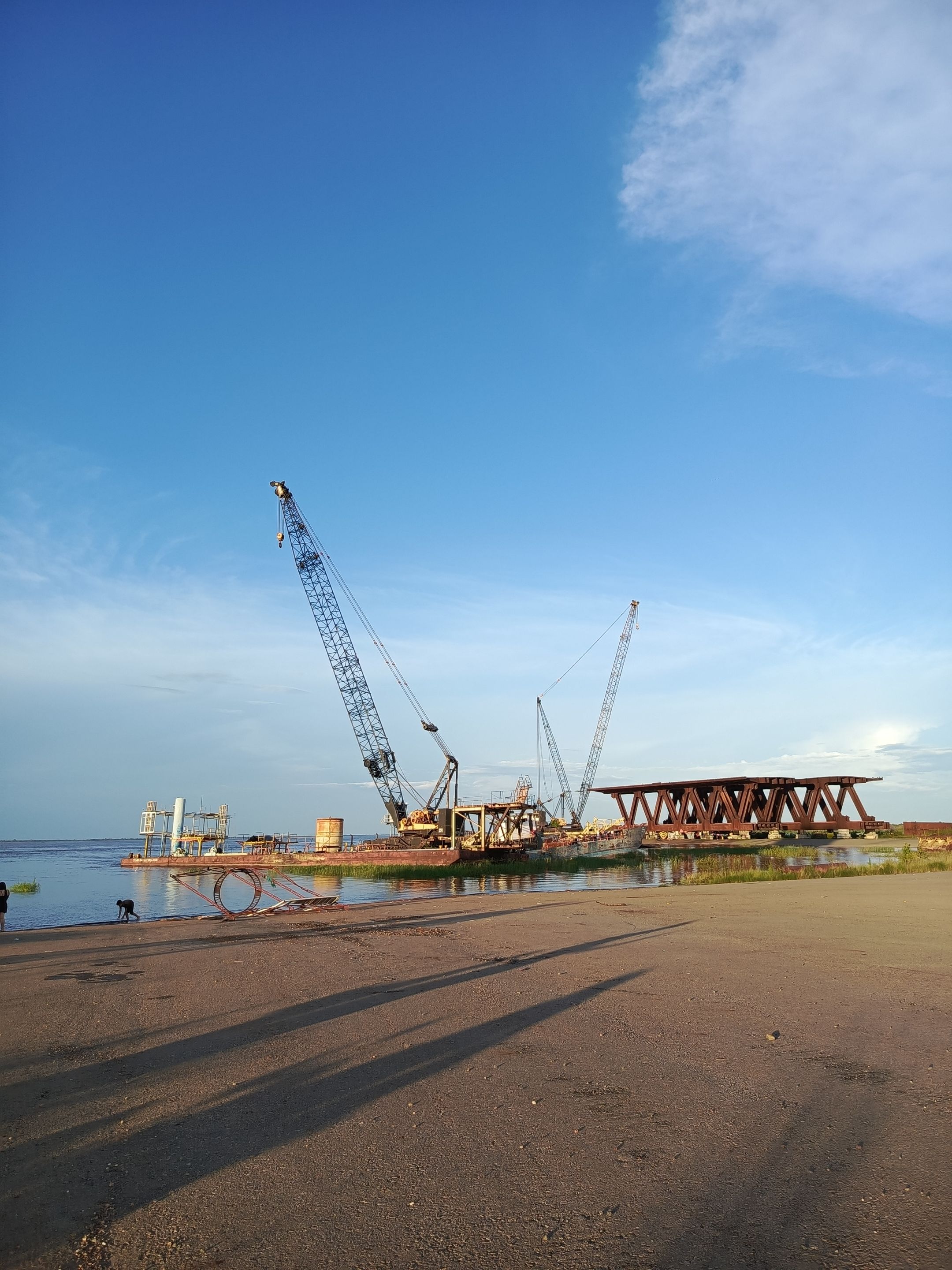
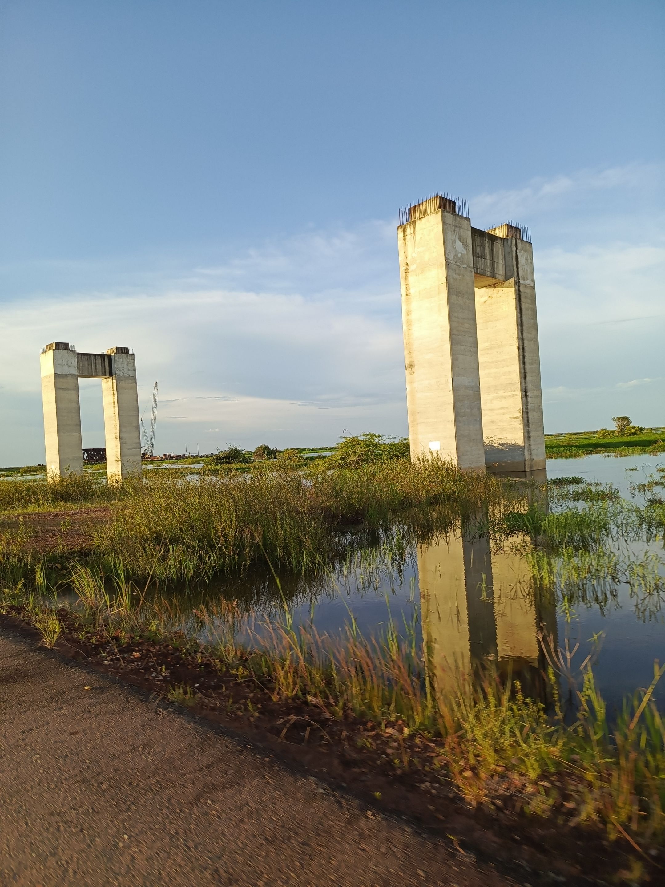
El recorrido lo hicimos en moto 🏍️ ,desde el pueblo donde vivo a la entrada de donde inicia la construcción hay aproximadamente 15 minutos y de la entrada hasta la parte final donde está el río hay unos 10 minutos de recorrido aproximadamente, se puede ver en todo el camino lo que son los pilotes, algunos están completamente concluidos, cerrados, estructuras de concreto y metal, otros están a la mitad, algunos están solamente lo que es las cabillas, quedaron hasta allí, luego llegamos a una parte donde se puede observar un tramo de aproximadamente 50, 60 m de estructura de hierro lo que sería la parte superior del puente para el tráfico vehicular; cabe acotar que este proyecto constaba de dos partes; una para el tráfico vehicular y por la parte inferior del puente sería ferroviaria, allí se puede observar el inicio del trabajo para la estructura ferroviaria.
We did the tour by motorcycle 🏍️, from the town where I live to the entrance where the construction begins there are approximately 15 minutes and from the entrance to the final part where the river is about 10 minutes of travel approximately, you can see all the way what are the piles, some are completely finished, Some of them are closed, concrete and metal structures, others are only half finished, some are just the piles, they were left until there, then we arrive to a part where you can see a stretch of approximately 50, 60 m of iron structure, which would be the upper part of the bridge for vehicular traffic; It should be noted that this project consisted of two parts; one for vehicular traffic and the lower part of the bridge would be for the railroad, there you can see the beginning of the work for the railroad structure.
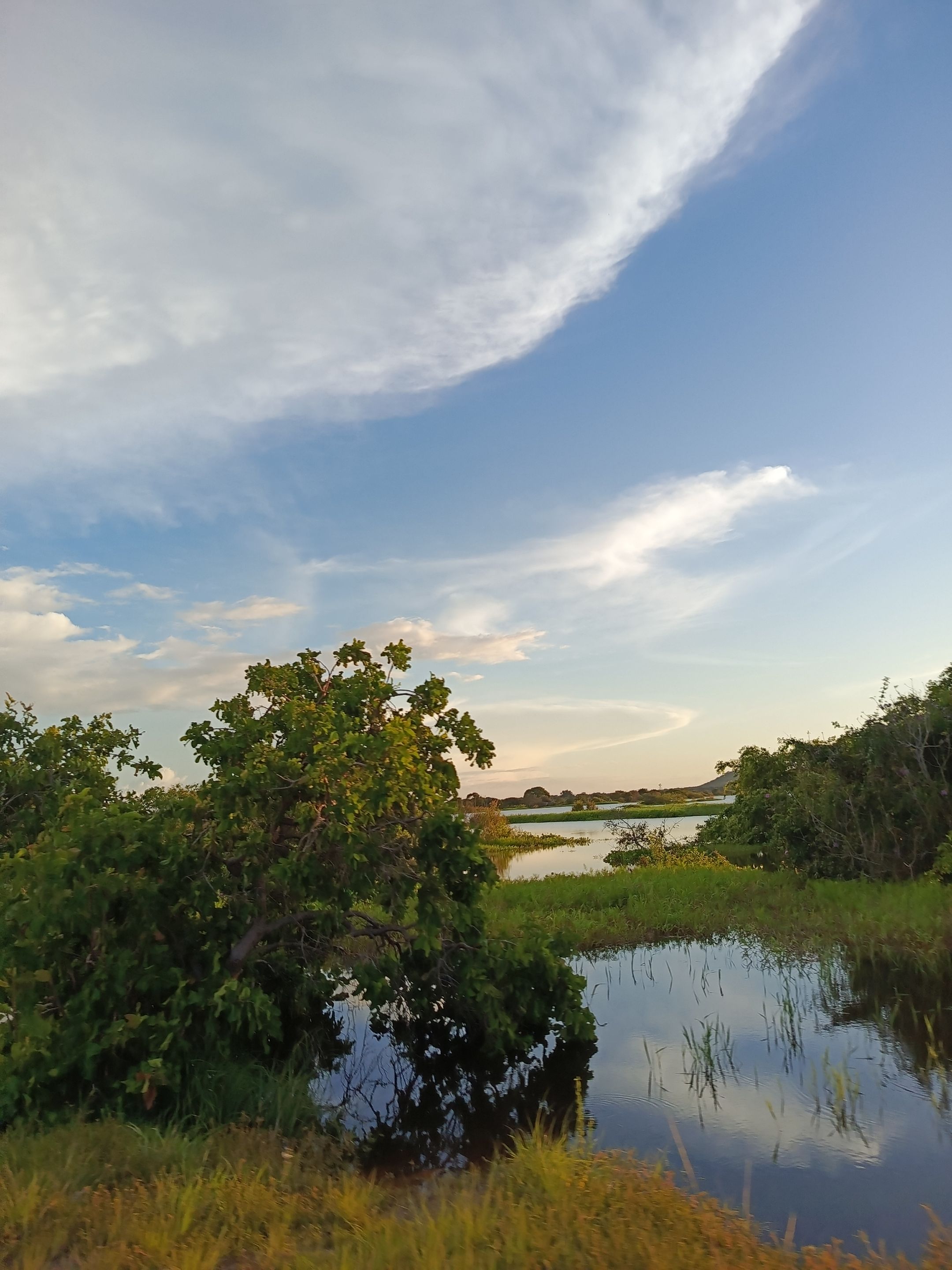
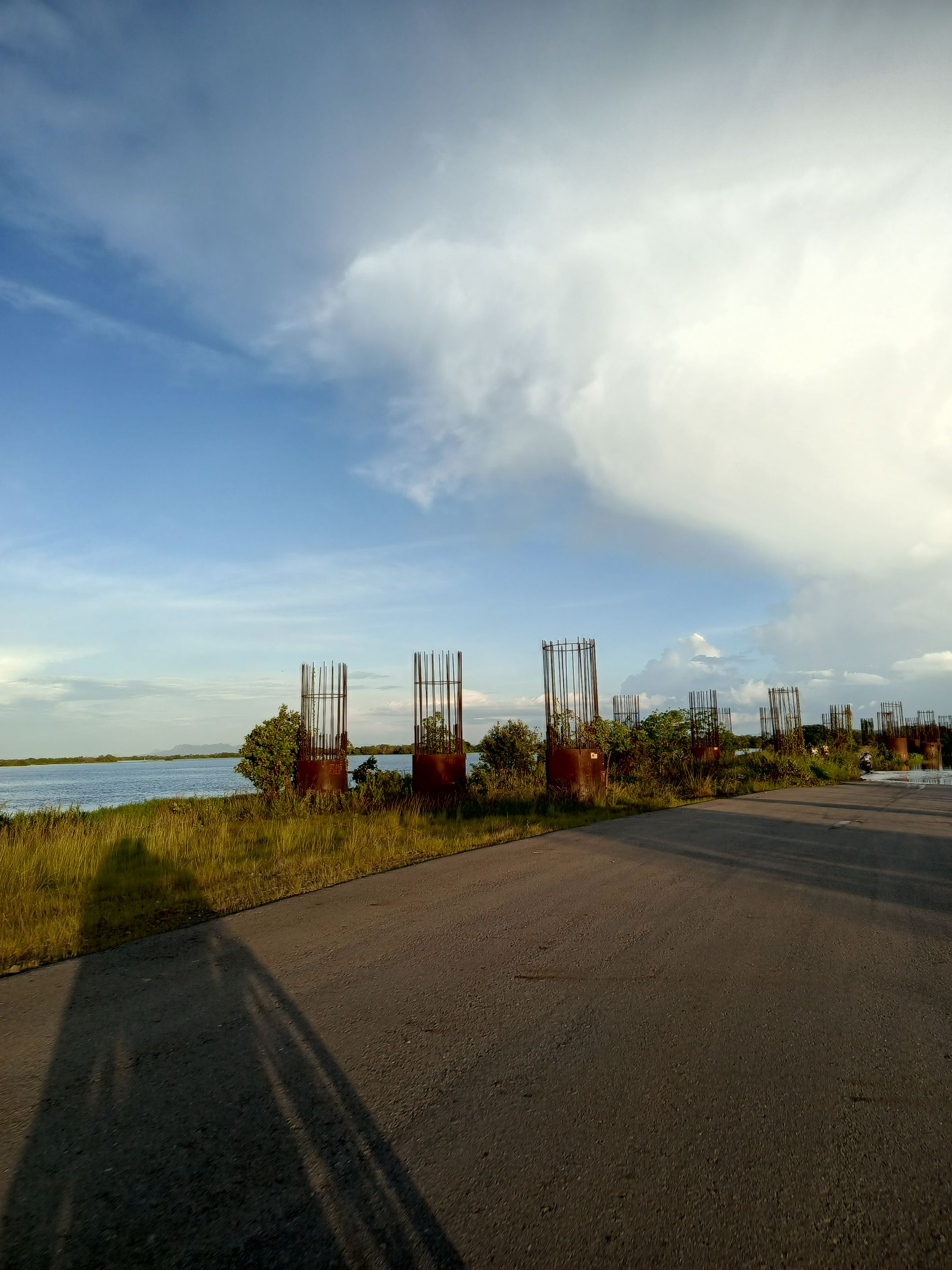
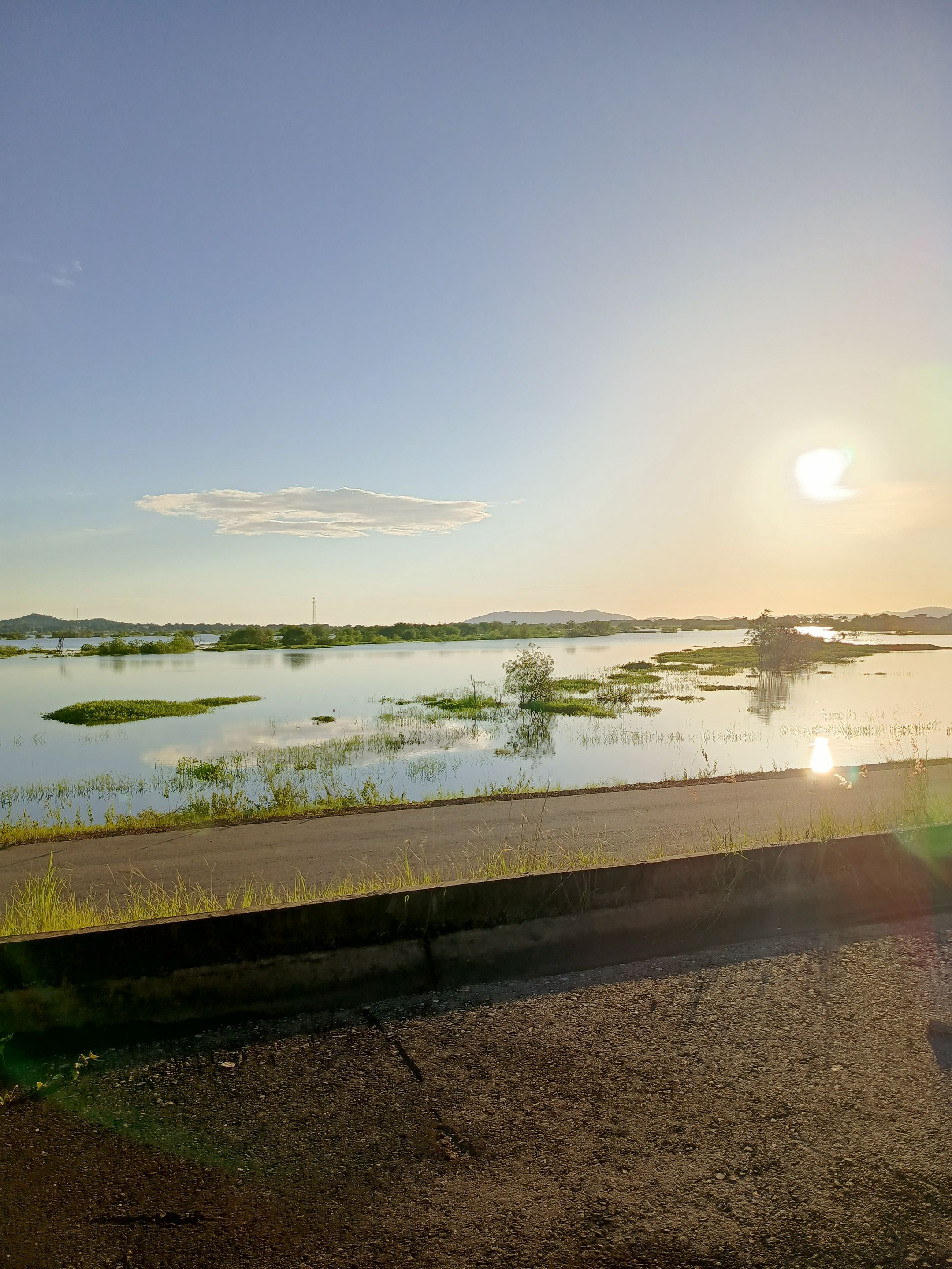
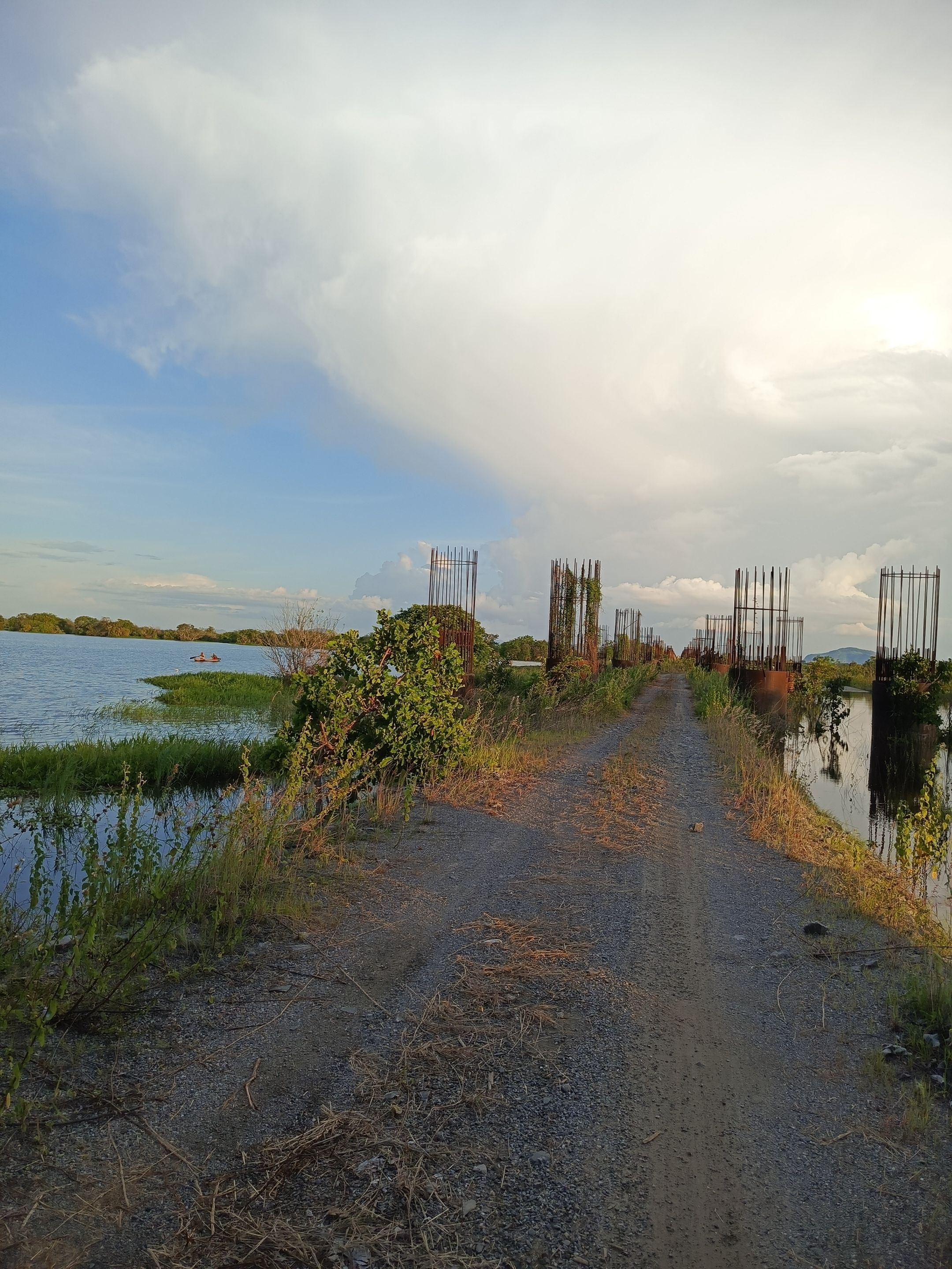
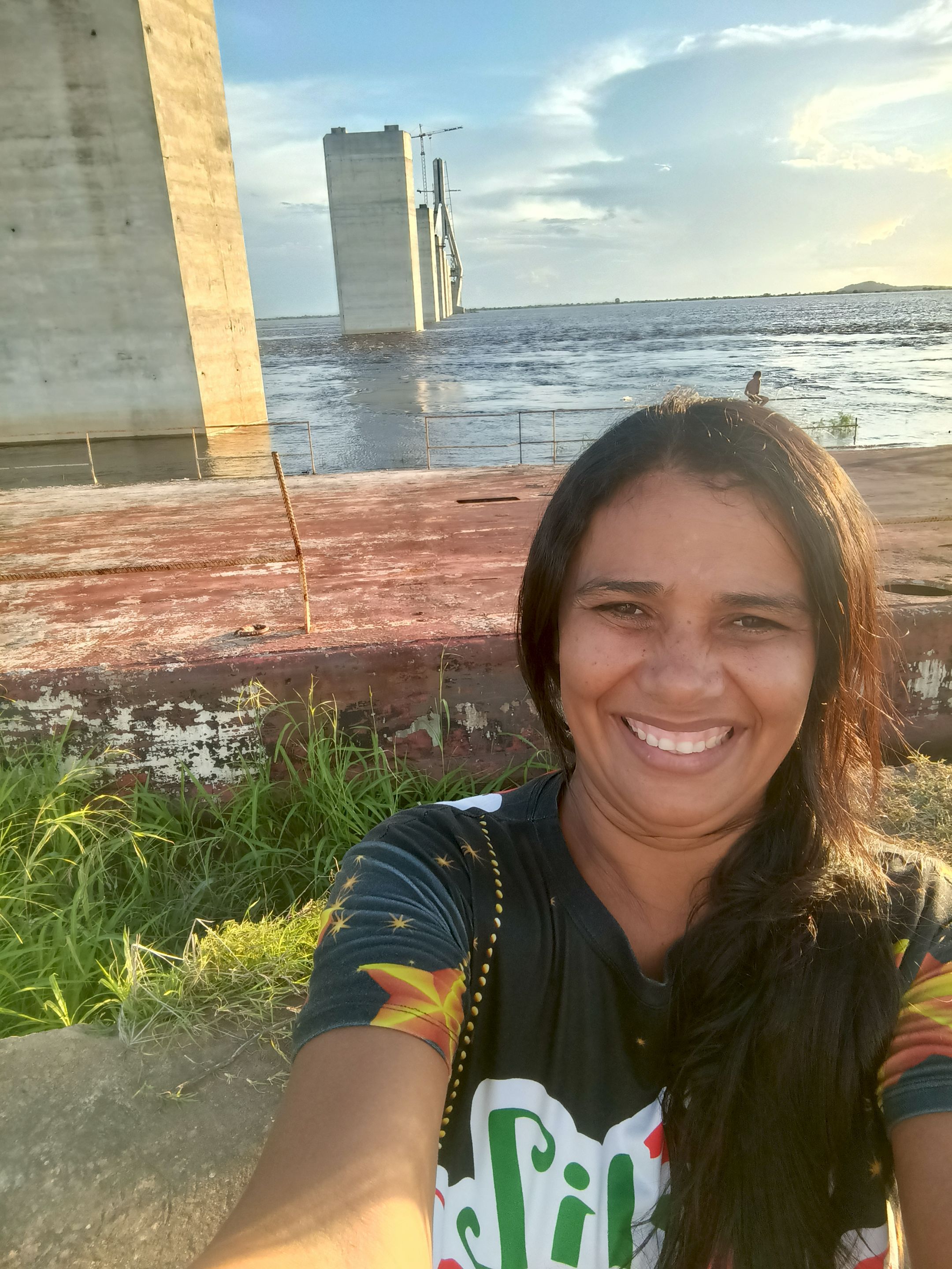
Con el abandono de esta obra el lugar también fue abandonado; pero este año para esta temporada de invierno y debido a la gran creciente que ha tenido nuestro río padre, a tal punto que ya está a las orillas de la carretera; de hecho hay tramos donde no se puede pasar por la carretera porque ya está completamente lleno, lo cual ha llevado a los transeúntes a crear un paso alterno hasta llegar a otro extremo donde no haya agua, es la única forma de llegar al final a donde es el inicio en sí de la construcción .
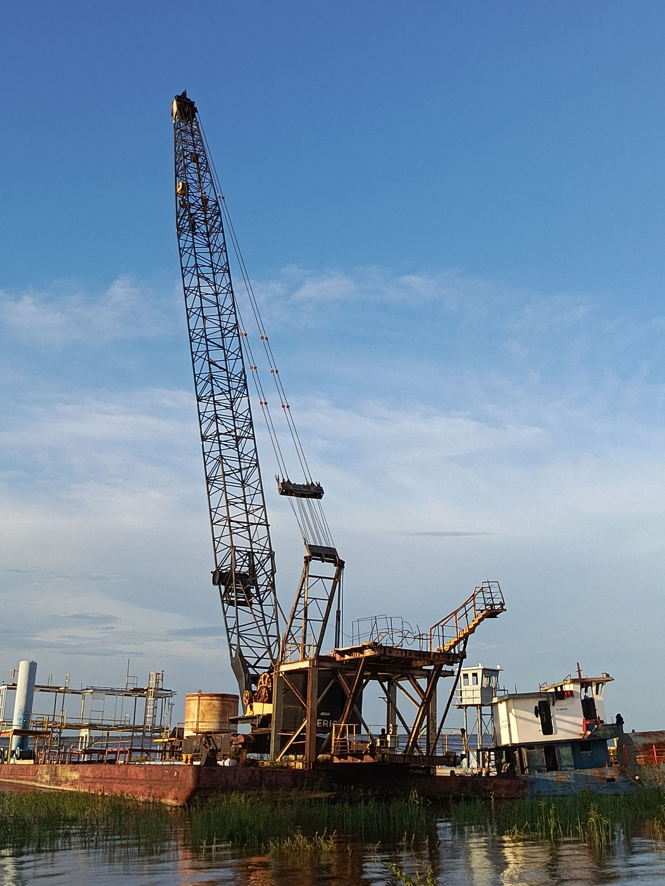
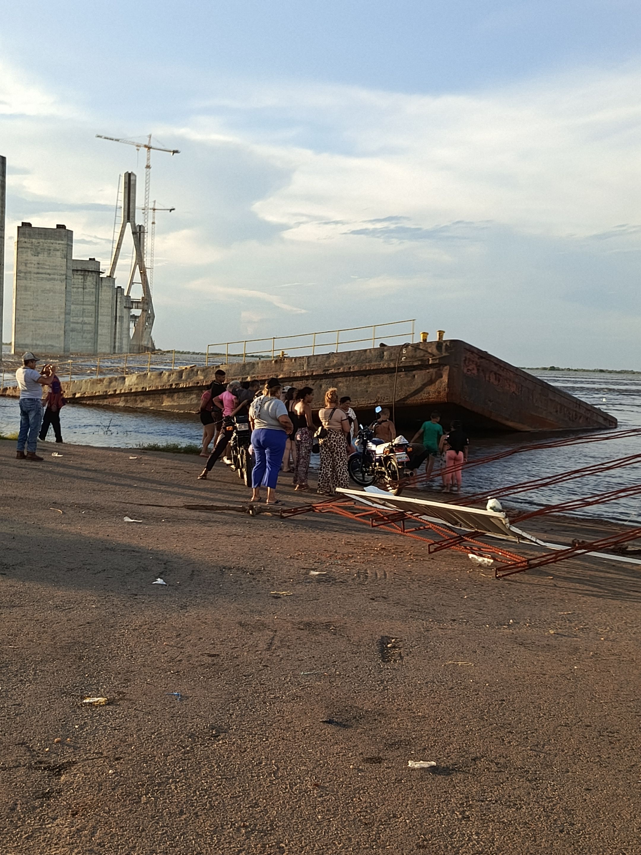
Allí se puede ver incluso la grúa que fue dejada allí en abandono, se observa una chalana que está ahorita completamente hundida, la cual utilizan las personas como mirador en el lugar, por supuesto este punto es a la fecha el principal atractivo turístico para los habitantes del pueblo y también para los visitantes .
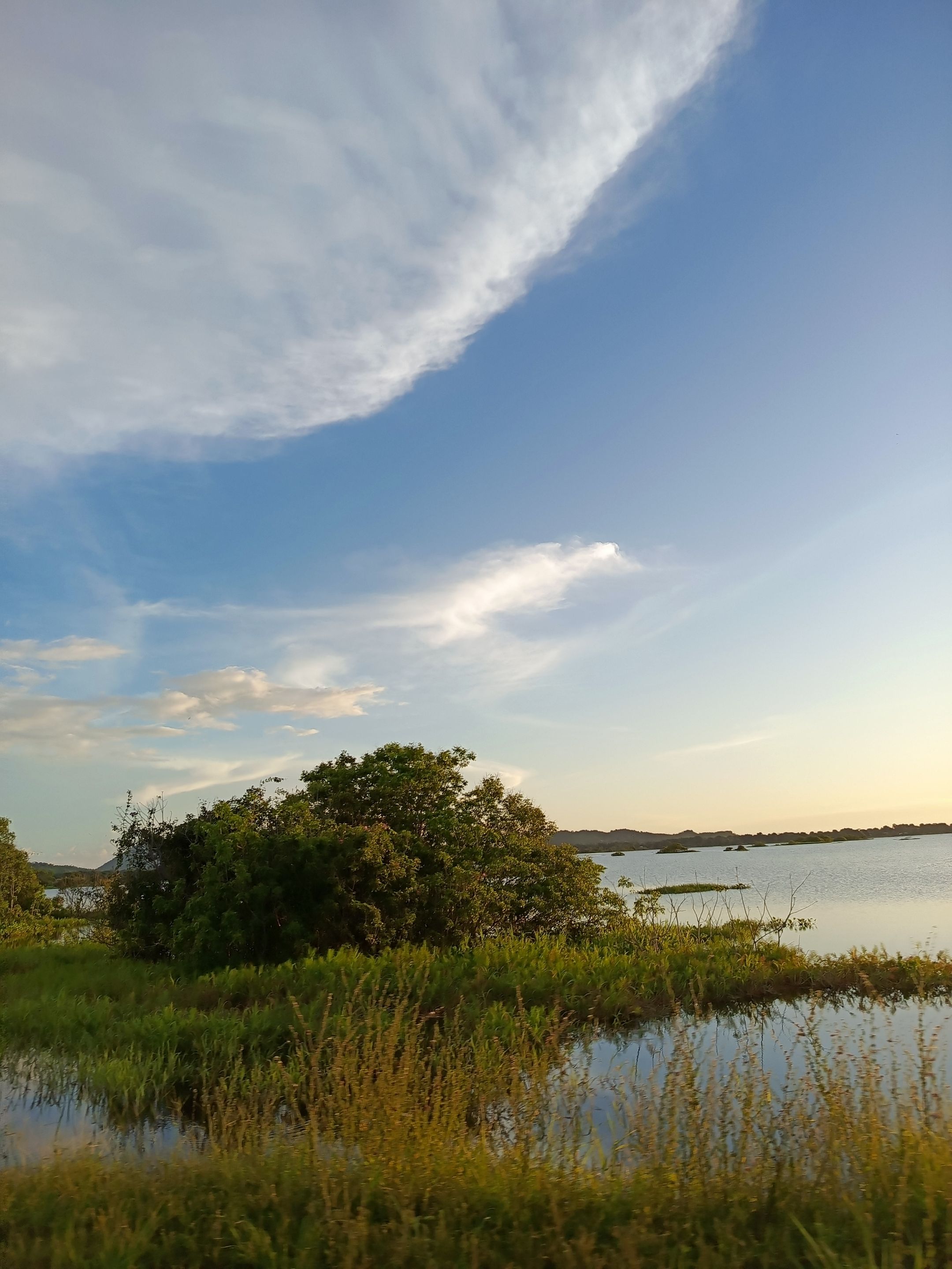
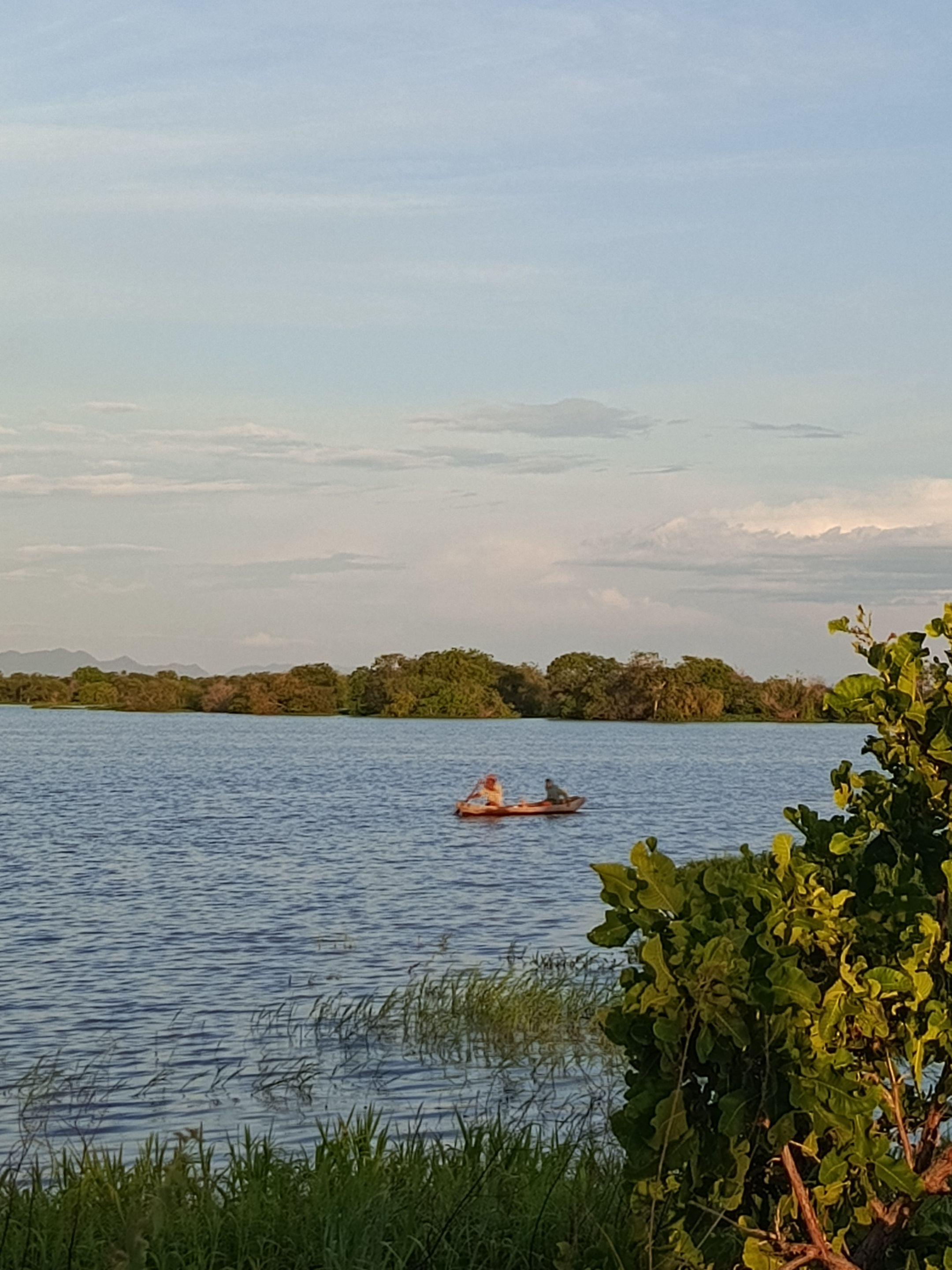
En estos momentos está lo que es la ribazón y allí se puede observar los pescadores, abunda lo que es la sapoara y el llamado bocachico que se puede adquirir a precio sumamente accesible; allí mismo en el río bocachico se consigue en 100 bolívares, las sapoaras se consigue en 200 bolívares ( no les muestro foto porque por lo general los pescadores están en la mañana y la visita la hicimos en hora de la tarde)🫣
También hay personas que van a practicar la pesca para el consumo de su familia, algunos lo hacen como deporte, los niños lo hacen como distracción; es realmente un lugar hermoso, pero hay de verdad que tener mucho cuidado porque aún en la orilla se puede observar la gran corriente que tiene el majestuoso río Orinoco.
Espero hayan disfrutado el recorrido tanto como yo, gracias por visitar mi blog, nos vemos en la próxima publicación.
Dios les bendiga🙏
With the abandonment of this project, the site was also abandoned. However, this year, for the winter season, due to the massive flooding of our main river, it has reached the edge of the road. In fact, there are stretches where the road is impossible to pass because it is already completely filled, which has led pedestrians to create an alternate route to reach the other end where there is no water. It is the only way to reach the end, where the construction actually begins.
There, you can even see the crane that was abandoned there. You can also see a barge that is now completely submerged, which people use as a lookout point. Of course, this spot is currently the main tourist attraction for the town's residents and visitors.
Right now, the riverbank is still there, and you can see the fishermen there. There is an abundance of sapoara and the so-called bocachico, which can be purchased at an extremely affordable price. Right there on the Bocachico River, you can get them for 100 bolívares, and sapoaras cost 200 bolívares (I'm not showing a photo because the fishermen are usually there in the morning, and we visited in the afternoon).
There are also people who go fishing for their families' consumption; some do it as a sport, while the children do it as a hobby. It's truly a beautiful place, but you really have to be very careful because even on the shore, you can see the strong current of the majestic Orinoco River.
I hope you enjoyed the tour as much as I did. Thank you for visiting my blog. See you in the next post.
God bless you. 🙏
No Translated with https://www.deepl.com/translator
      Todas las imágenes son de mi autoría, capturadas con mi teléfono ZTE.

   All images are my own, captured with my ZTE phone.
Posted Using INLEO
[//]:# ([//]:# (!worldmappin 7.66634 lat -66.14935 long d3scr))
Comments (2)
You can check out this post and your own profile on the map. Be part of the Worldmappin Community and join our Discord Channel to get in touch with other travelers, ask questions or just be updated on our latest features.
Que fotos tan increíbles definitivamente ❣️
Si es un lugar increíble.
Saludos 🙏