Caicara de Orinoco es un pequeño pueblo que está a orillas de el majestuoso río padre, de hecho de allí deriva su nombre ; cada año cuando entra la temporada de invierno siempre en el pueblo se vive la angustia, la zozobra de cuán grande será la creciente de ese año y qué consecuencias traerá?
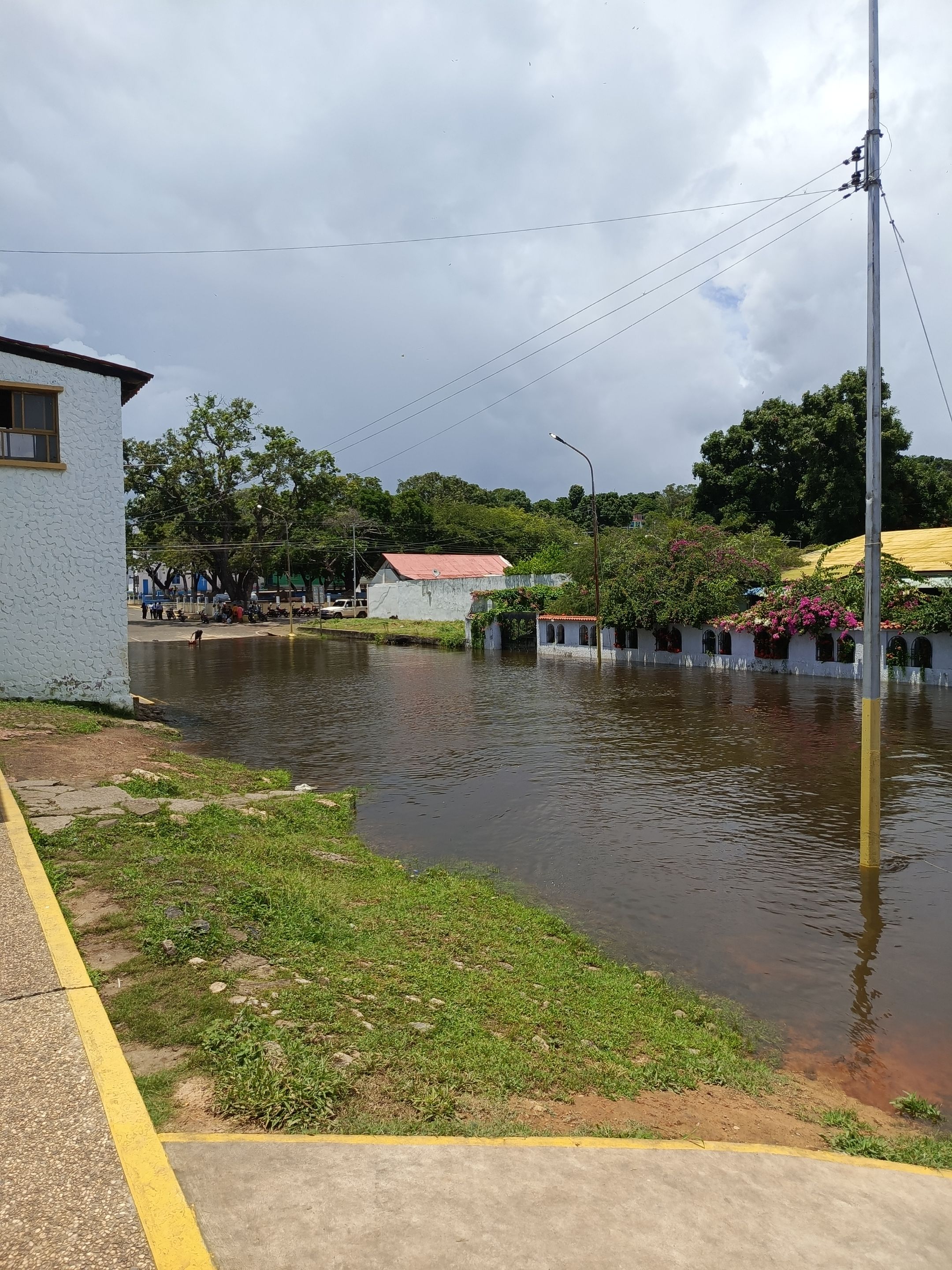
En el año 2018 la creciente fue muy grande y no se había repetido hasta este año que pasó por encima de los 35 m sobre el nivel del mar ;esto trae muchas consecuencias negativas, por así decirlo para el pueblo; sobre todo para las personas que viven en sus adyacencias.
Todas estas personas se ven obligadas a dejar sus hogares, eso implica sacar todos sus enseres, buscar lugares donde ser ubicados; la mayoría ,los que no tienen algún familiar que los recibe en casa se ubican en refugios, en el pueblo se utilizan las escuelas, los liceos para acoger a las personas damnificadas.
Caicara de Orinoco is a small town that is on the banks of the majestic Padre River, in fact that is where it derives its name; every year when the winter season begins, the town is always anxious and anxious about how big the flood will be that year and what consequences it will bring?
In 2018, the flood was very large and had not been repeated until this year, when it passed over 35 m above sea level; this brings many negative consequences, so to speak, for the town, especially for the people who live in the vicinity.
All these people are forced to leave their homes, that implies taking out all their belongings, looking for places where to be located; most of them, those who do not have a family member to receive them at home are located in shelters, in the town, schools and high schools are used to receive the affected people.
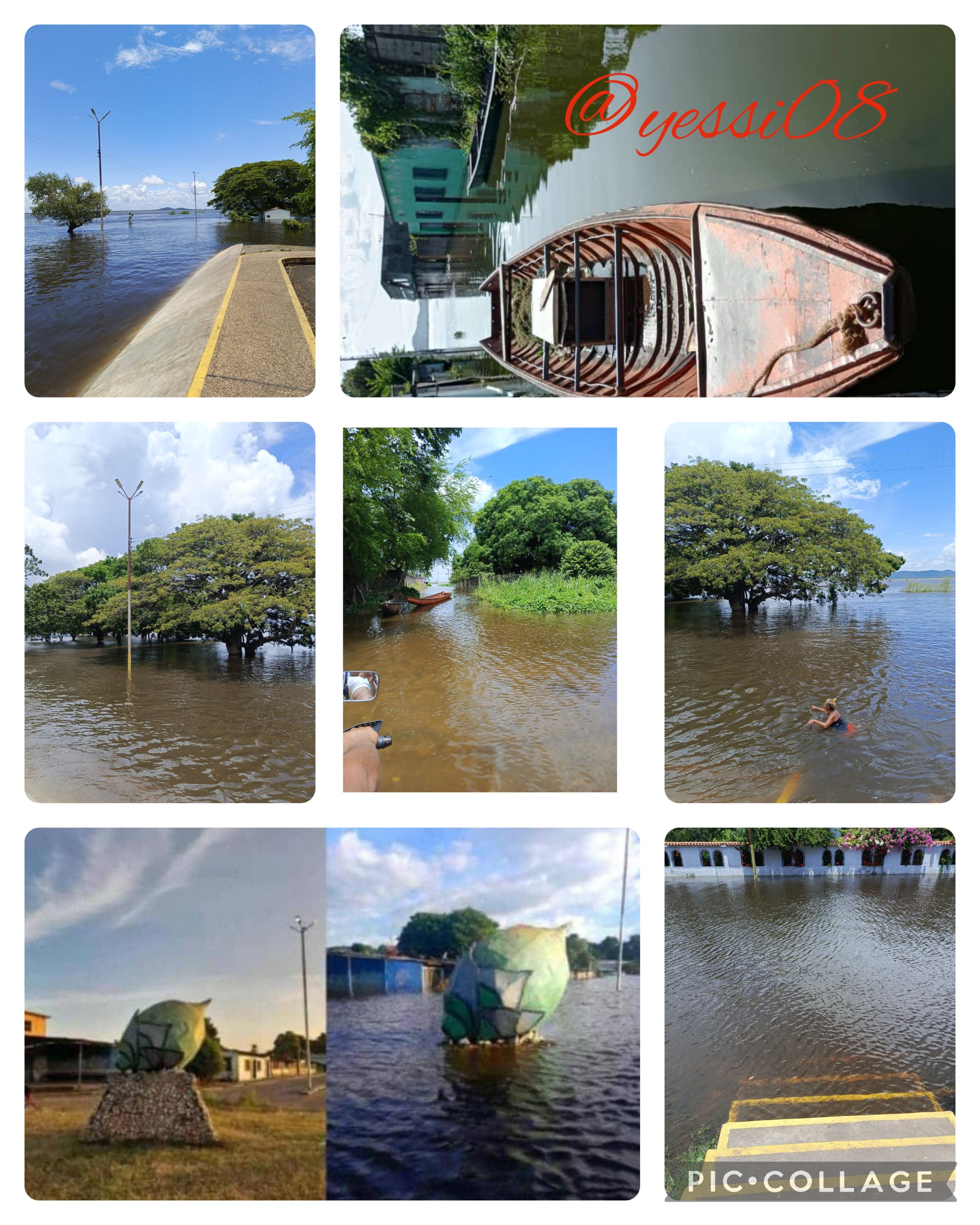
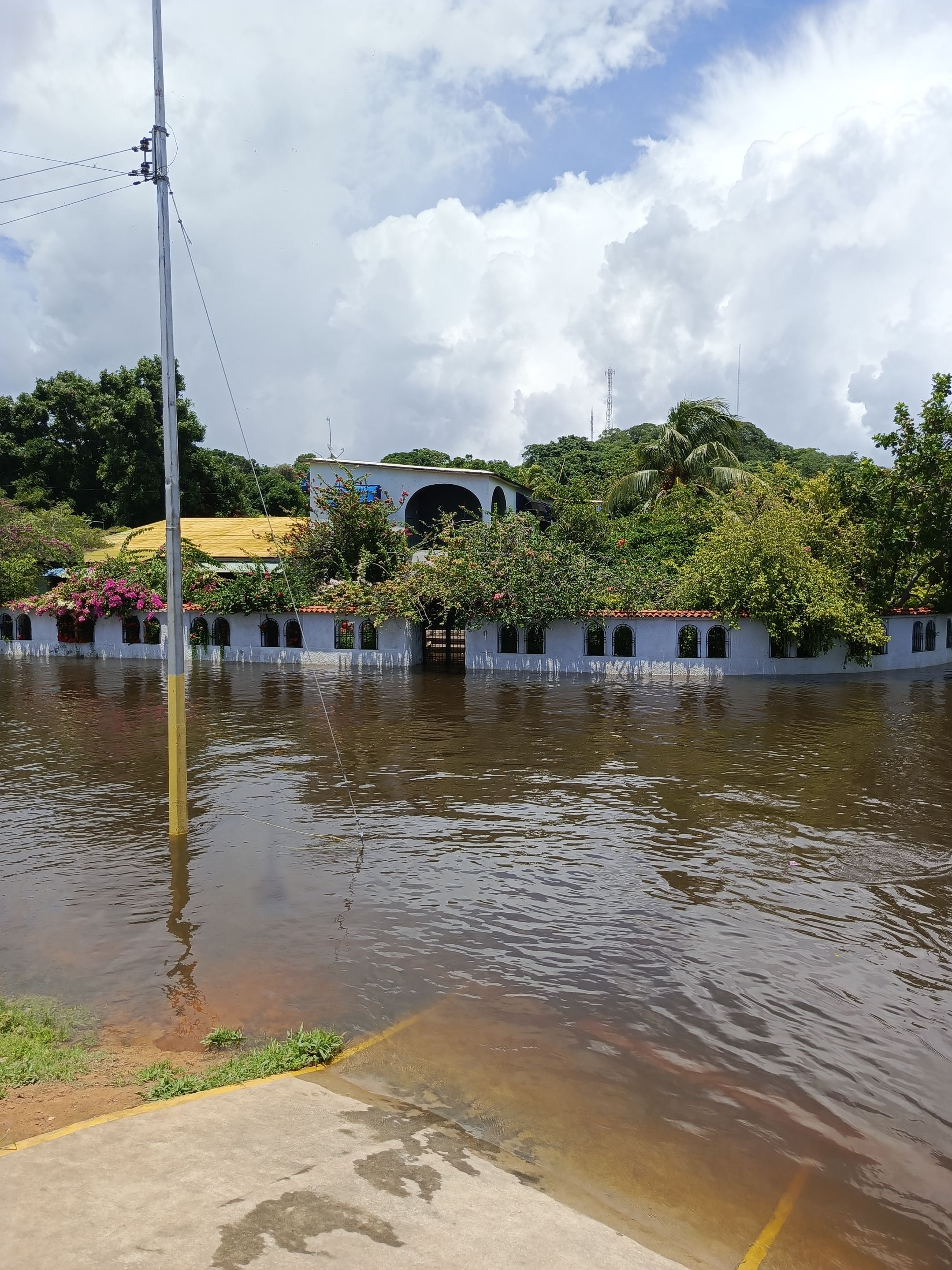
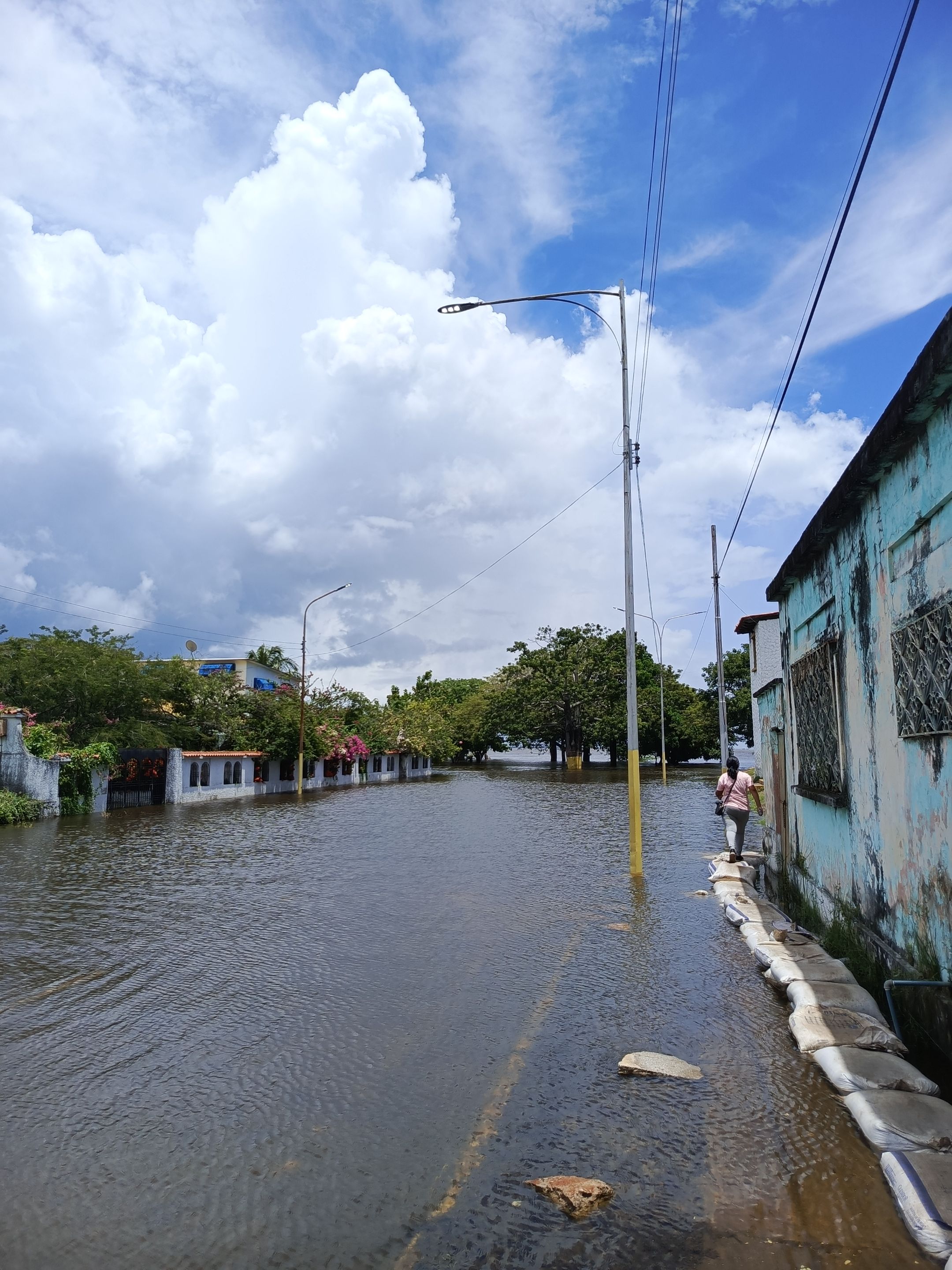
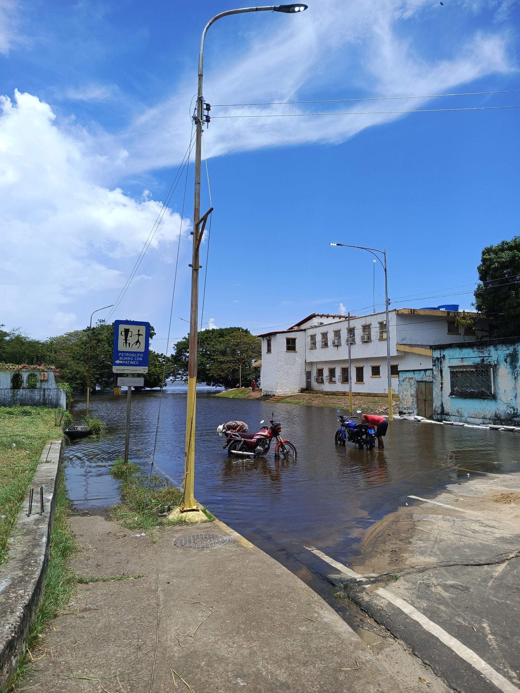
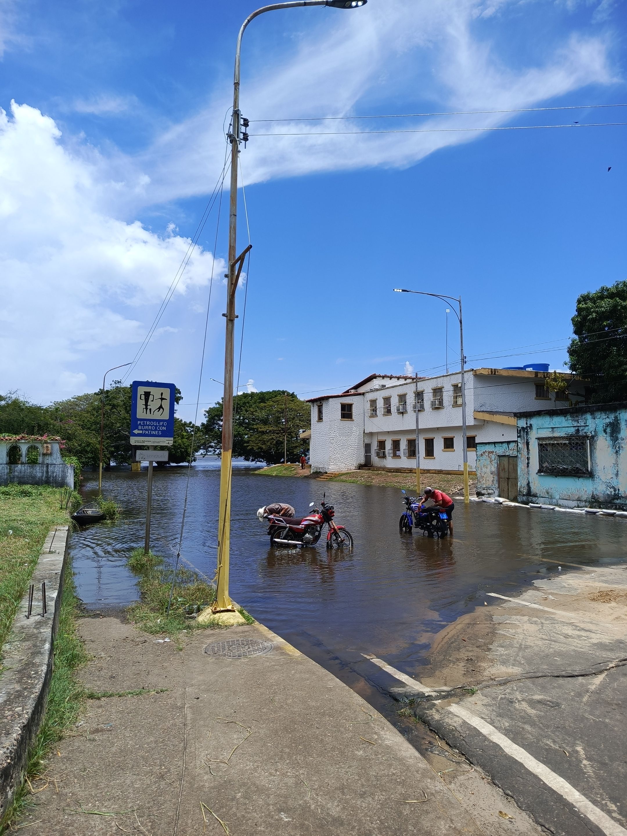
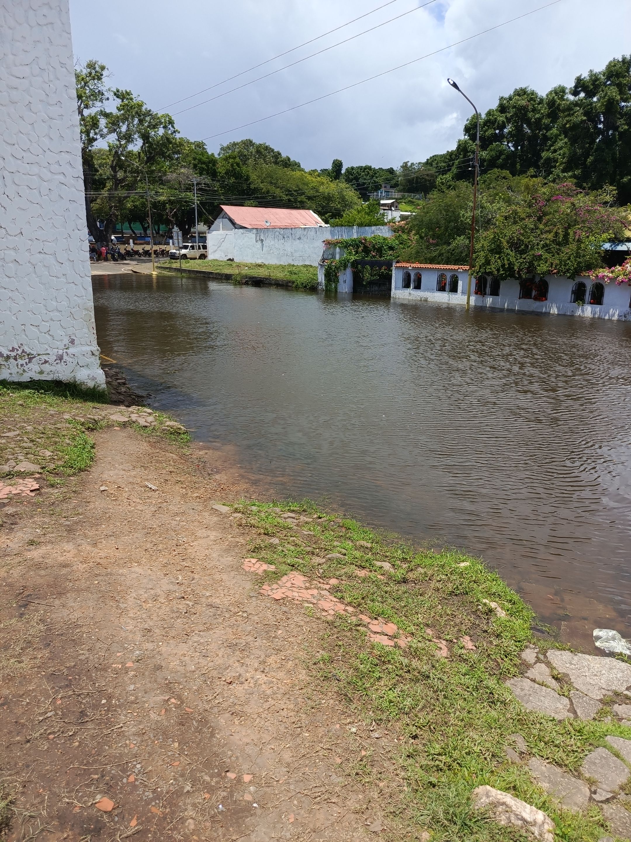
El día de ayer decidí acercarme a las adyacencias del río, y hacer este video, no quise compartirles solamente fotos, porque creo que en un video pueden apreciar mejor la magnitud de la creciente, el lugar al cual me dirigí es la alcaldía del municipio, que está ubicada a orillas del río, les explico para que entiendan mejor 🫣
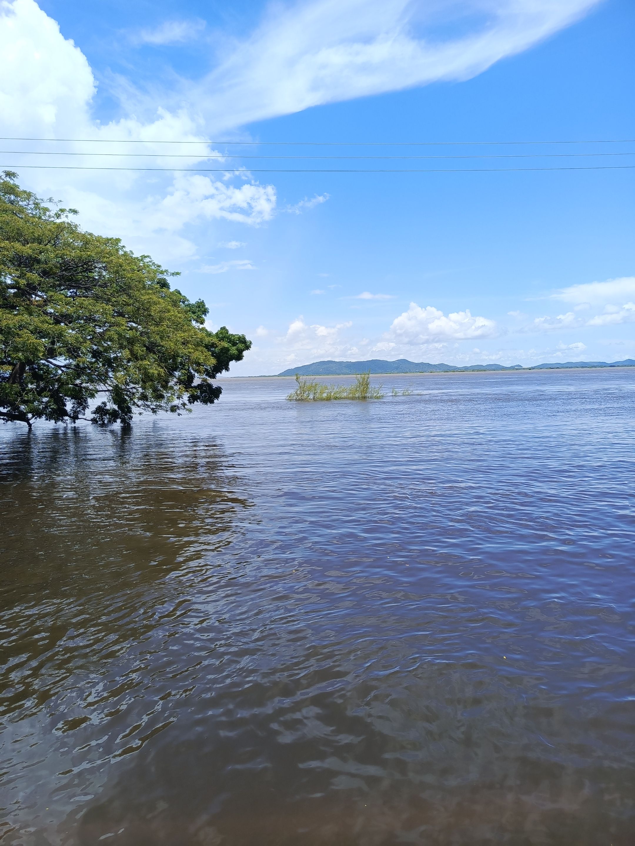
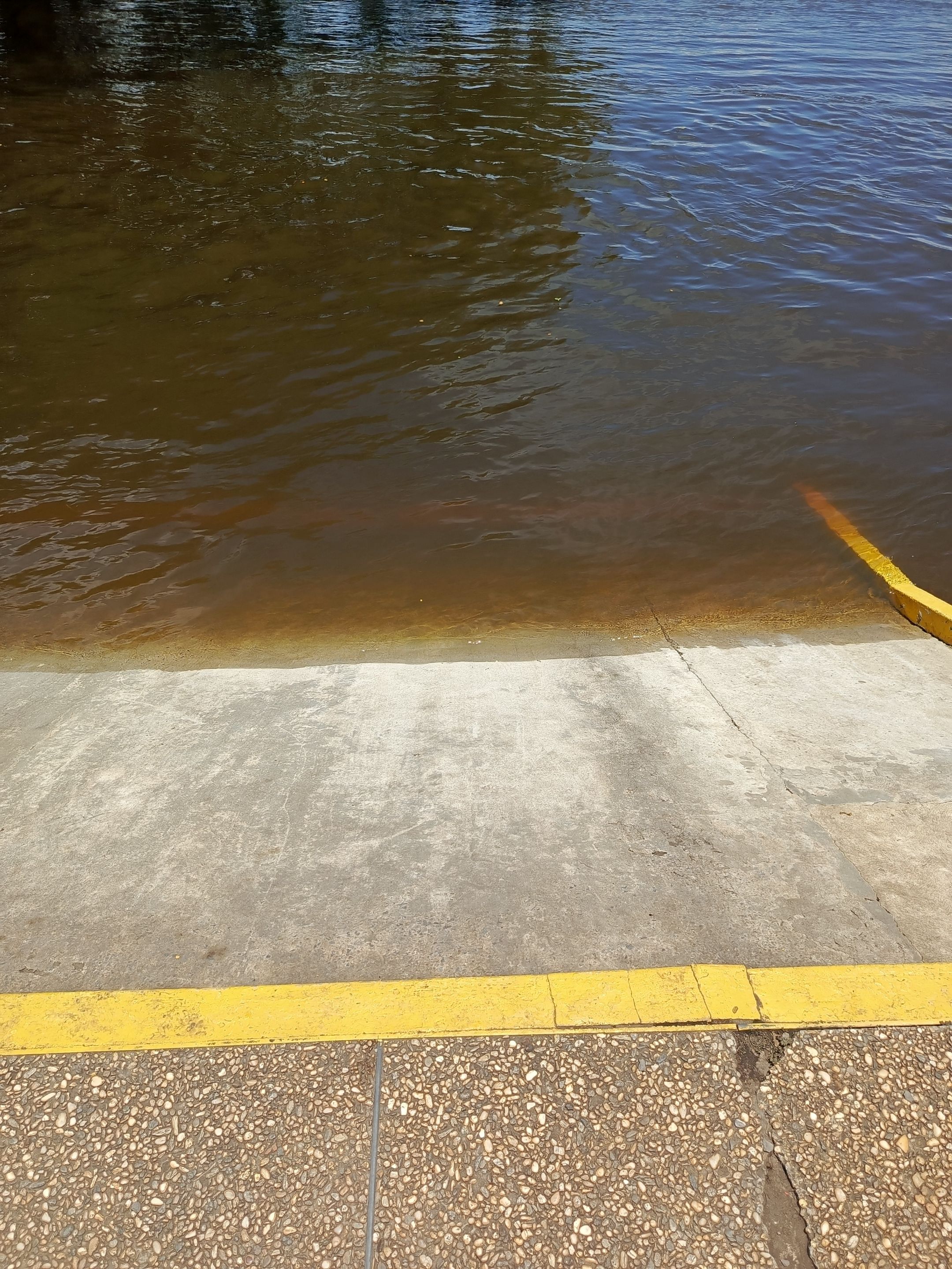
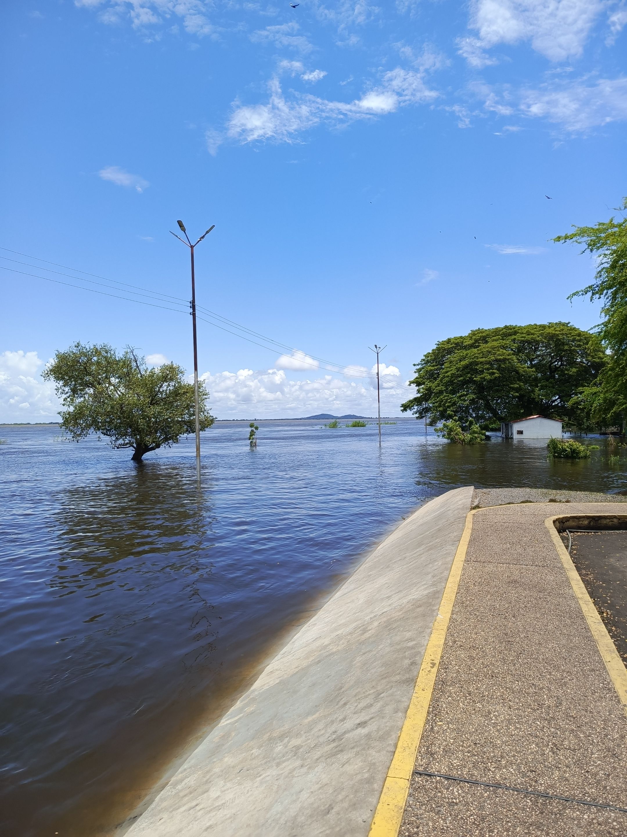
En su cauce normal el río está aproximadamente a unos 5 metros de profundidad y unos 5 metros de distancia de la acera, dónde comienza la calle y están ubicados unos bancos que se utilizan para la recreación familiar .
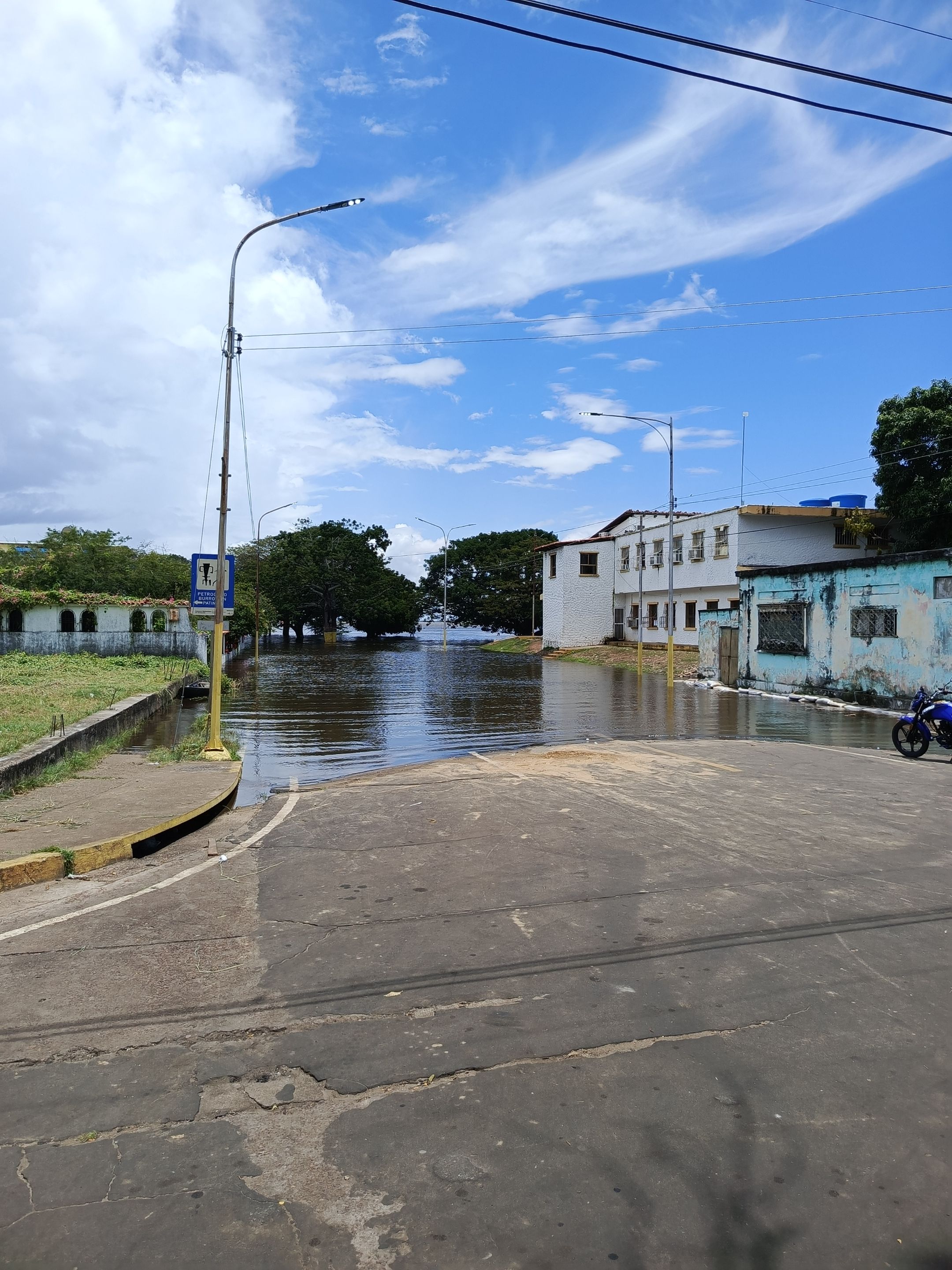
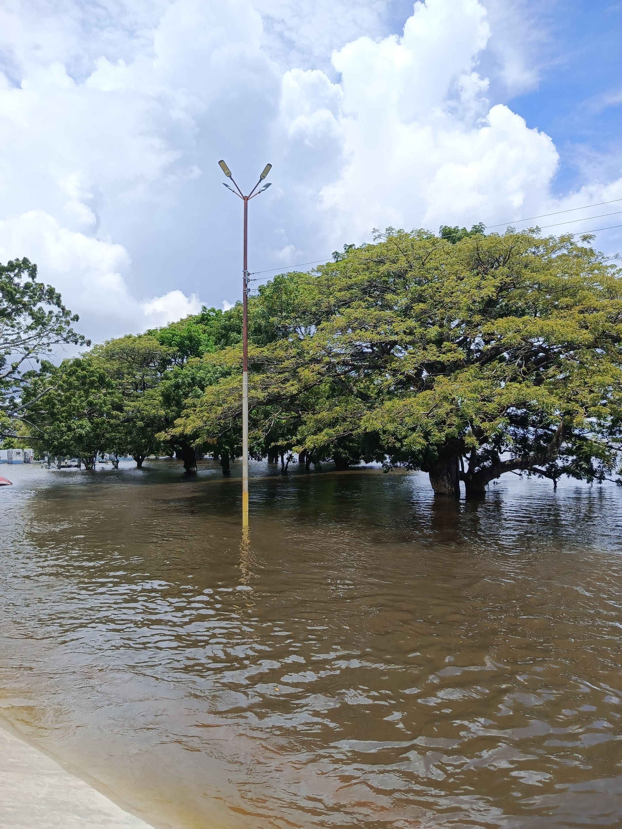
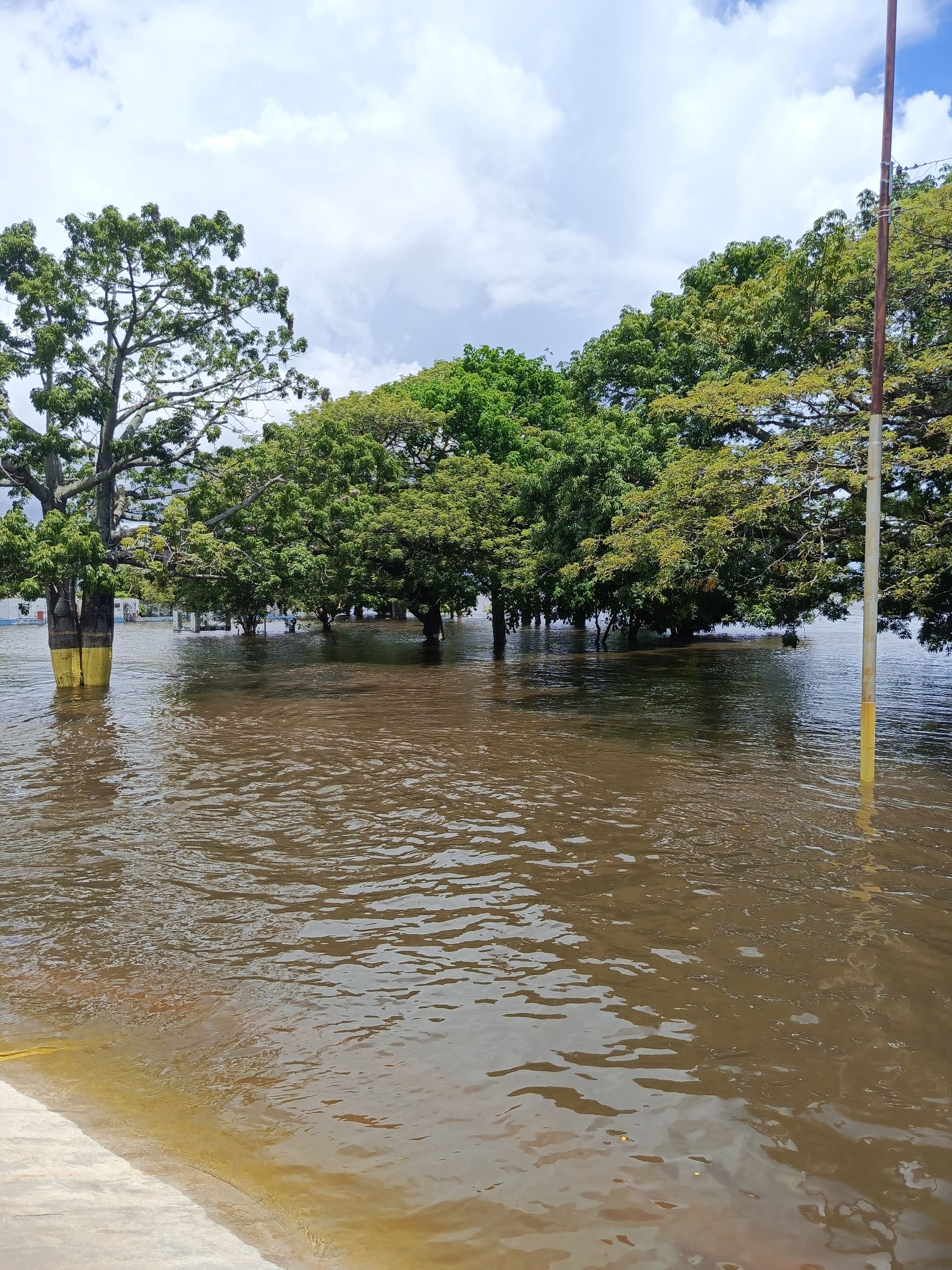
A partir de allí donde están ubicados los bancos comienza la calle que tiene un ancho de aproximadamente unos 6 m, allí luego comienza lo que sería la alcaldía que se encuentra en la parte alta aproximadamente a unos 2 m de altura desde la acera, bueno este año la creciente del río ya está a la orilla de lo que es la alcaldía incluso allí en las fotos pueden ver que ya algunas escaleras de acceso a la edificación de la alcaldía ya están llenas de agua, la calle completamente llenas de agua, en la foto que está frente a la alcaldía en esos árboles grandes que se ven allí, es donde están los bancos de aproximadamente 50 -60 cm de alto, todos están tapados.
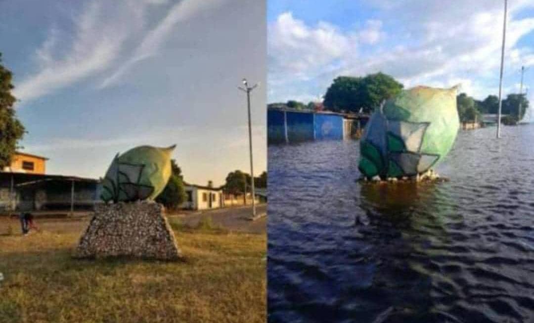
Una de las fotos que les muestro allí donde hay una comparación, lo que es una estatua a la coroba que es el fruto típico del municipio, pueden ver que la estructura de la coroba está sobre una base que tiene una altura de más de un metro y ya la base está completamente cubierta de agua, es más o menos para que uno se haga una idea de la magnitud de la creciente de el río Orinoco de este año.
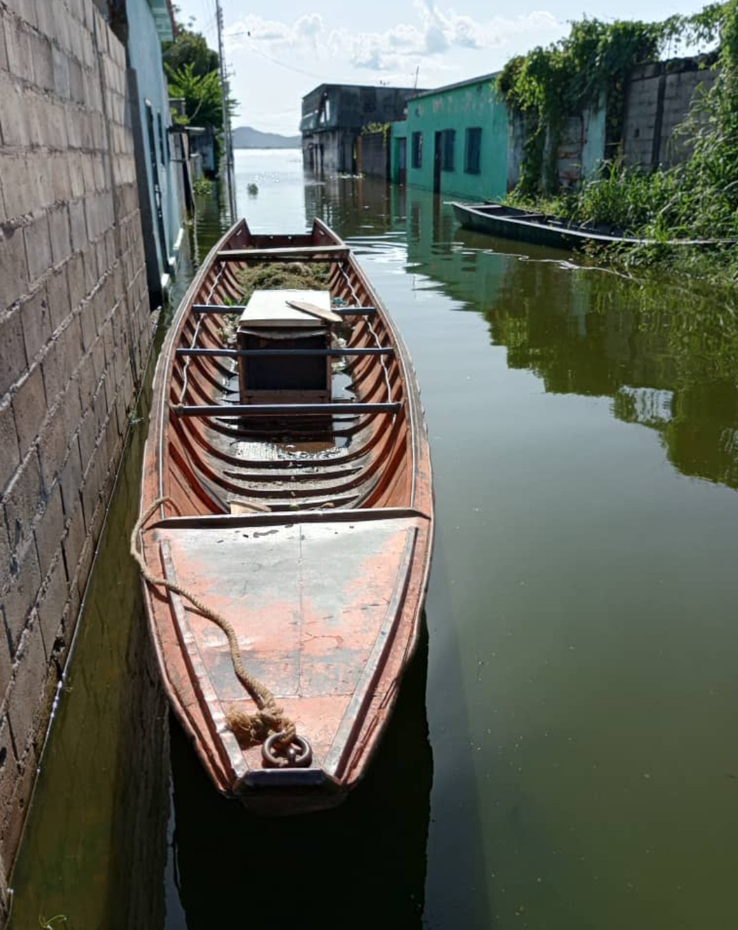
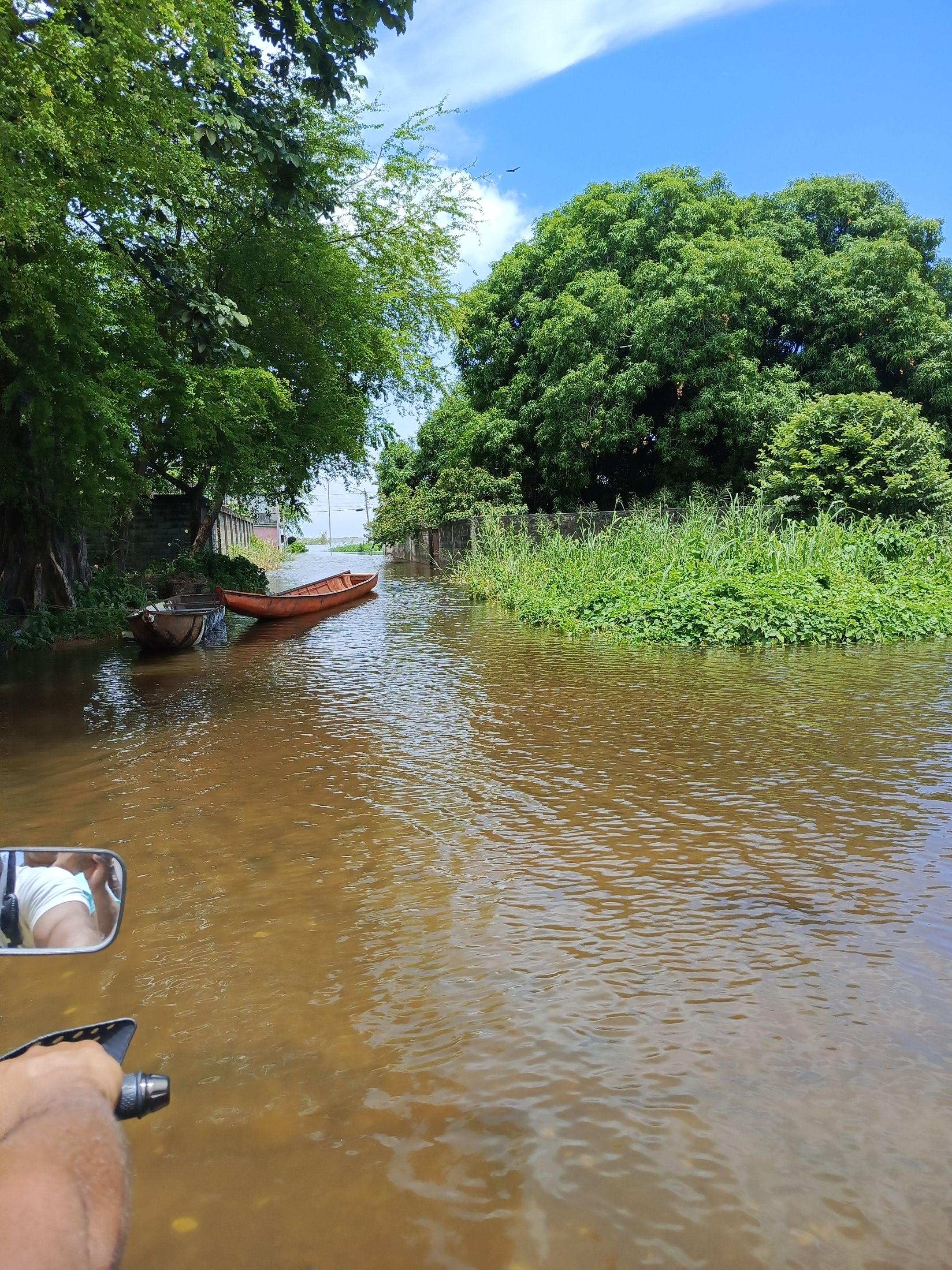
En otra de la foto se puede apreciar las canas o curiaras pasando frente a las casas que han tenido que ser abandonadas porque realmente la corriente es bastante fuerte y la única forma de poder transitar es en curiara.
Otra de las cosas negativas que traen las inundaciones es la cantidad de animales peligrosos que salen precisamente por la creciente del Río ;este año allí mismo frente a la alcaldía se pudieron ver tembladores a plena luz del día, y en la noche, animales que sabemos son muy peligrosos, también la cantidad de serpientes que salen representan un peligro para los habitantes de nuestra población.
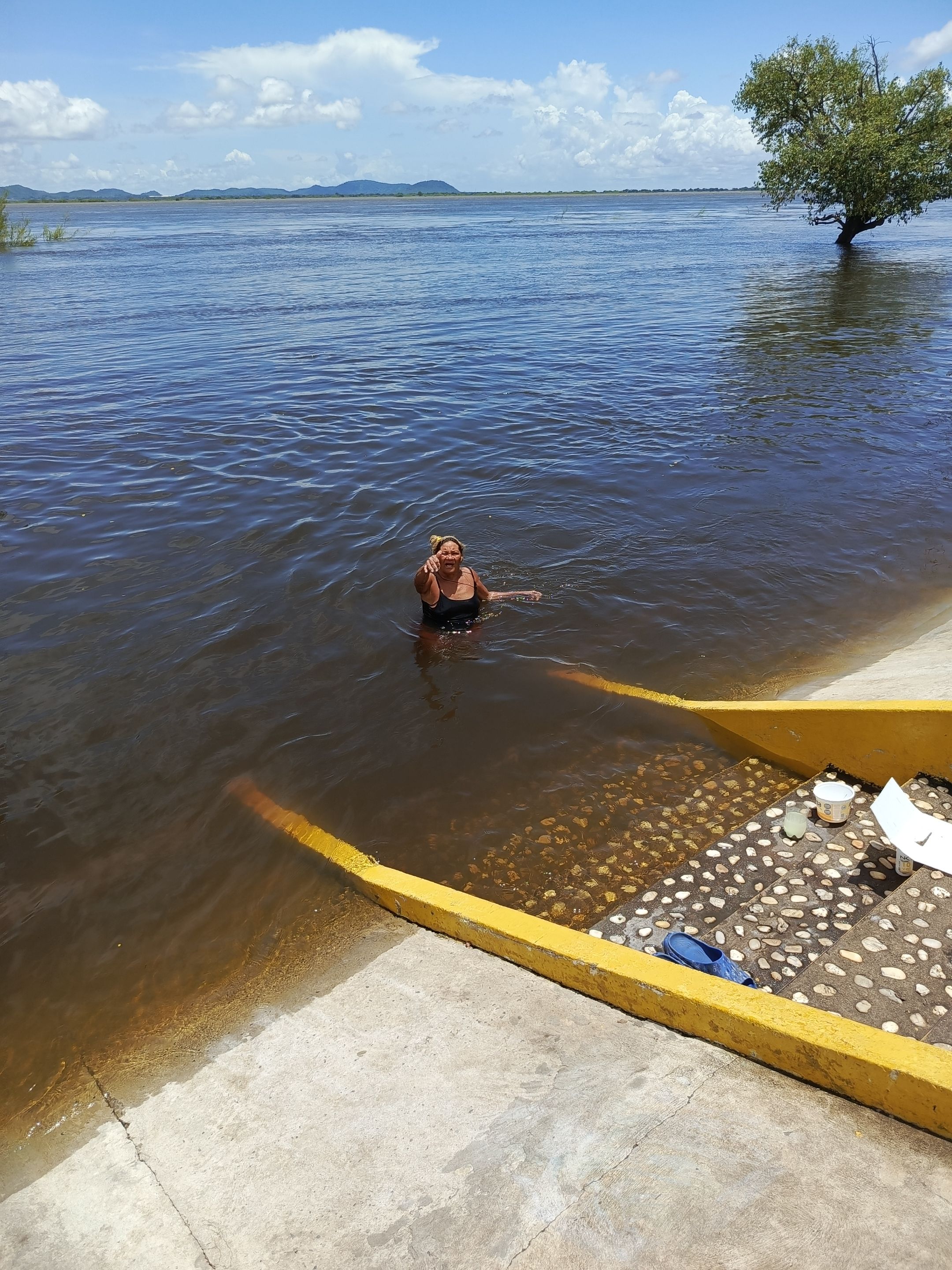
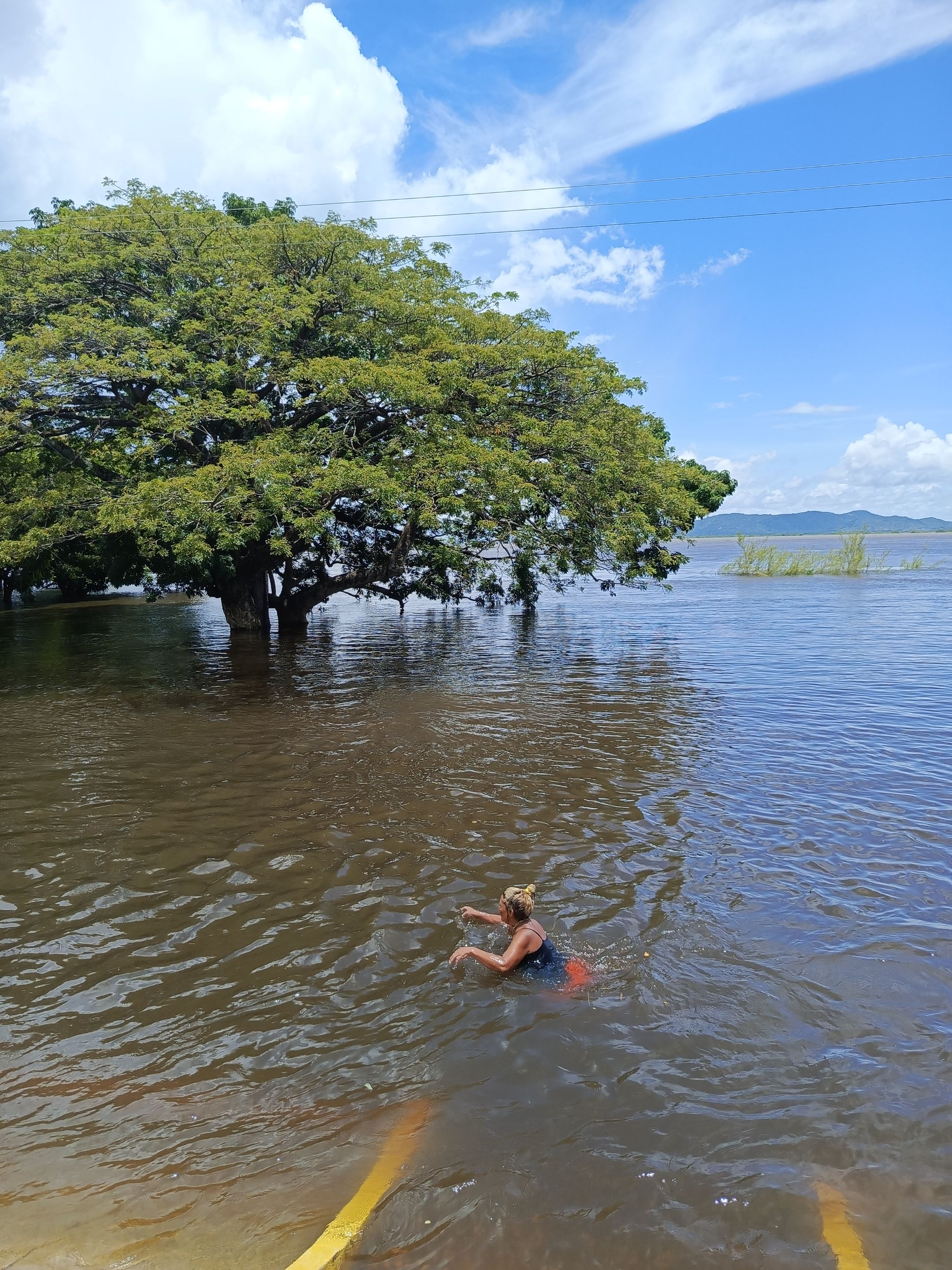
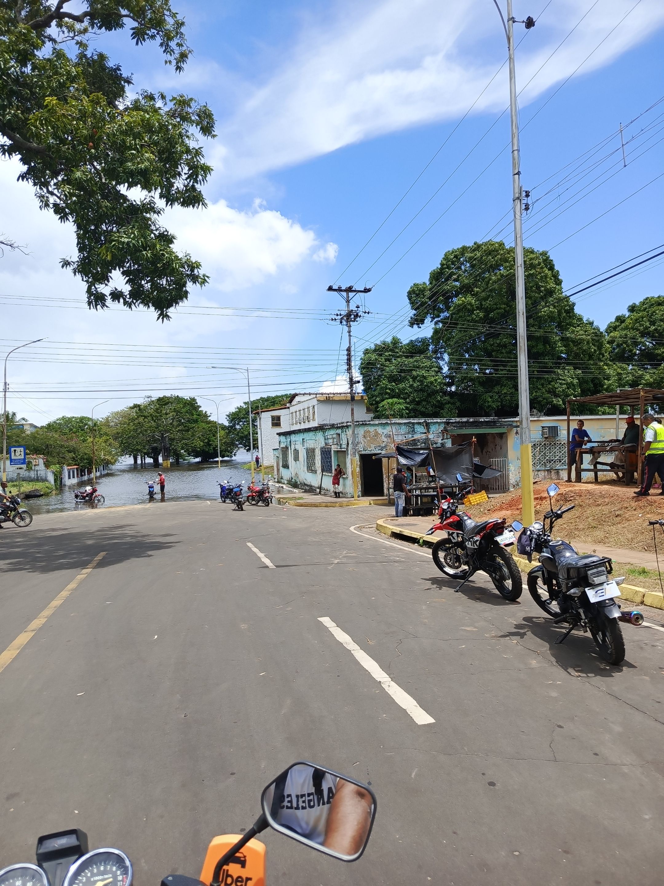
Pero como siempre el venezolano trata de buscarle el lado positivo a las cosas, también se aprovecha la creciente para convertir la orilla del río en el punto de encuentro familiar ;a partir de lo que son las 2 -3 de la tarde se pueden ver a las familias allí reunidas, los niños se bañan, juegan se recrean.
Incluso este año se creó una ruta turística que consiste en un paseo en canoa por toda la extensión del río para que se pueda apreciar de cerca la magnitud de la creciente del majestuoso río Orinoco.
Se espera que para mediados del mes de agosto el río comience a ceder, las aguas comiencen a bajar y en los próximos días vuelva a su cauce normal; espero te haya gustado el recorrido que te hice por mi pequeño pueblo en lo que fue la creciente de este año 2025.
Nos vemos en la próxima 🙏
Yesterday, I decided to go near the river and make this video. I didn't want to just share photos because I think a video can better appreciate the magnitude of the flood. The place I went to is the municipal hall, which is located on the banks of the river. I'll explain so you can better understand 🫣
In its normal course, the river is approximately 5 meters deep and about 5 meters from the sidewalk, where the street begins and where there are some benches used for family recreation.
From there, where the benches are located, the street begins, approximately 6 meters wide. Then, what would be the city hall begins, located at the top, approximately 2 meters high from the sidewalk. This year, the river's flooding has already reached the edge of what is the city hall. In the photos, you can see that some of the stairs leading to the city hall building are already filled with water. The street is completely filled with water. In the photo in front of the city hall, those large trees you can see there are where the benches are, approximately 50-60 cm high. They are all covered.
In one of the photos I show you where there is a comparison, which is a statue to the coroba which is the typical fruit of the municipality, you can see that the structure of the coroba is on a base that has a height of more than a meter and the base is already completely covered with water, it is more or less enough to give one an idea of the magnitude of the flooding of the Orinoco River this year.
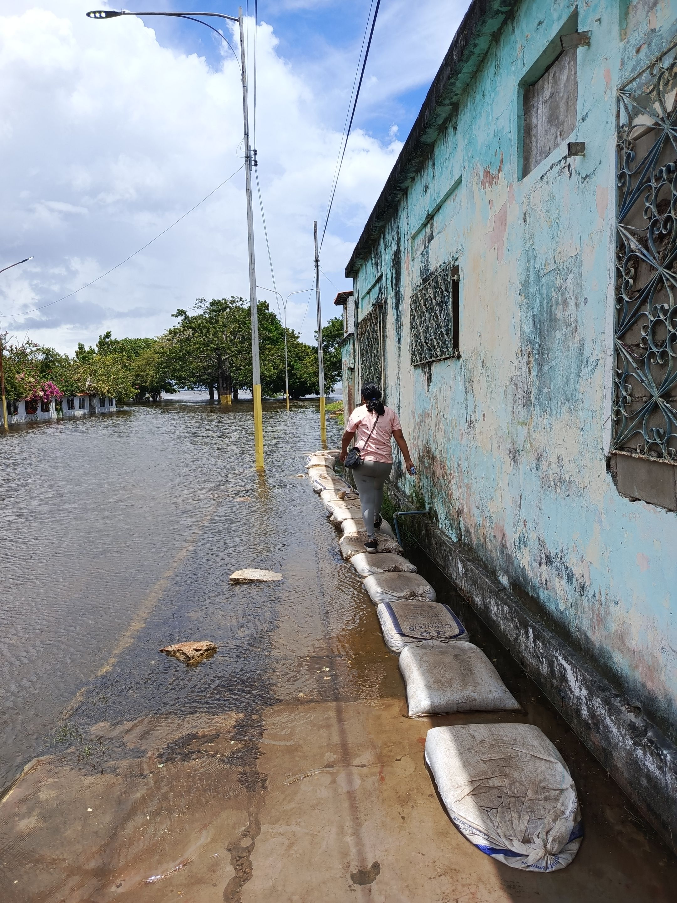
In another photo you can see the canas or curiaras passing in front of the houses that have had to be abandoned because the current is really quite strong and the only way to travel is in curiara.
Another negative thing that the floods bring is the amount of dangerous animals that come out precisely because of the rising of the river; this year right in front of the mayor's office we could see tremors in broad daylight, and at night, animals that we know are very dangerous, also the amount of snakes that come out represent a danger for the inhabitants of our town.
But as always Venezuelans try to look for the positive side of things, they also take advantage of the flood to turn the river bank into a family meeting point; From 2 - 3 o'clock in the afternoon you can see the families gathered there, the children bathe, play and have fun.
Even this year a tourist route was created that consists of a canoe ride along the entire length of the river so that the magnitude of the majestic Orinoco River's rise can be appreciated up close.
It is expected that by mid-August the river will begin to subside, the waters will begin to recede and in the next few days it will return to its normal course; I hope you liked the tour I took you through my little town during the flood of this year 2025.
See you next time 🙏
Translated with https://www.deepl.com/translator
      Todas las imágenes son de mi autoría, capturadas con mi teléfono ZTE.

   All images are my own, captured with my ZTE phone.
▶️ 3Speak
[//]:# ([//]:# (!worldmappin 7.64473 lat -66.17834 long d3scr))
Comments (1)
Has sido votado por
PROYECTO ENLACE
'Conectando Ideas y Comunidades'
PROYECTO ENLACE es un proyecto de curación de habla hispana enfocado en recompensar contenido de calidad y apoyar autores en su proceso de crecimiento en HIVE.
Creemos y apostamos por el futuro de esta gran plataforma, y estamos muy emocionados de poder hacerla crecer junto a esta comunidad. Así que te invitamos a publicar en nuestra COMUNIDAD y estar atento a todas las actividades que tenemos preparadas y que estaremos publicando en breve.
¿QUIERES AUTOMATIZAR TUS GANANCIAS DE CURACIÓN? SE PARTE DEL PROYECTO ENLACE APOYANDO A NUESTRO TRAIL EN HIVE.VOTE INGRESA AQUÍ PARA CONOCER LOS DETALLES.
¿QUIERES INVERTIR ENLACE? DESCUBRE COMO HACERLO Y GENERAR INGRESOS DE FORMA SEMANAL MEDIANTE TU DELEGACIÓN DE HP AQUÍ TE EXPLICAMOS COMO.
Te invitamos a participar en nuestro servidor de Discord: https://discord.gg/3S9y7BbWfS
Atentamente
EQUIPO ENLACE 2025
Gracias por el apoyo 🙏